
Mission type Meteorology COSPAR ID 2011-061A Mission duration 5 years Inclination 98.7° Period 1.7 hours Cost 8.1 billion USD | SATCAT no. 37849 Bus BCP-2000 Perigee 833,700 m Launch date 28 October 2011 | |
Manufacturer Ball Aerospace & Technologies Similar Aqua, Terra, Polar, GOES‑16, GOES 13 | ||
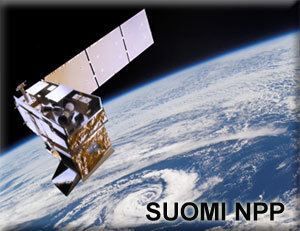
The Suomi National Polar-orbiting Partnership or Suomi NPP, previously known as the National Polar-orbiting Operational Environmental Satellite System Preparatory Project (NPP) and NPP-Bridge, is a weather satellite operated by the United States National Oceanic and Atmospheric Administration. Originally intended as a pathfinder for the NPOESS programme, which was to have replaced NOAA's Polar Operational Environmental Satellites and the U.S. Air Force's Defense Meteorological Satellite Program, Suomi was launched in 2011 after the cancellation of NPOESS to serve as a gapfiller between the POES satellites and the Joint Polar Satellite System which will replace them. Its instruments provide climate measurements that continue prior observations by NASA's Earth Observing System.
Contents
The satellite is named after Verner E. Suomi, a meteorologist at the University of Wisconsin–Madison. The name was announced on January 24, 2012, three months after the satellite's launch.
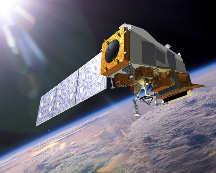
The satellite was launched from Space Launch Complex 2W at Vandenberg Air Force Base in California by a United Launch Alliance Delta II 7920-10C on October 28, 2011. The satellite was placed into a sun-synchronous orbit 824 km (512 miles) above the Earth.
Nasa s suomi npp earth observing satellite
History
NPOESS Preparatory Project (NPP) is intended to bridge the gap between old and new systems by flying new instruments, on a new satellite bus, using a new ground data network. Originally planned for launch five years earlier as a joint NASA/NOAA/DOD project, NPP was to be a pathfinder mission for the larger National Polar-orbiting Operational Environmental Satellite System until DOD participation in the larger project was dissolved. The project continued as a civilian weather forecasting replacement for the NOAA Polar Operational Environmental Satellites (POES) series, and ensured continuity of climate measurements begun by NASA's Earth Observing System.
The spacecraft was launched 28 October 2011 from Vandenberg Air Force Base via a Delta II in the 7920-10 configuration (Extra Extended Long Tank with RS-27A engine first stage, 9 GEM-40 solid rocket motors, type 2 second stage with Aerojet AJ10 engine, no 3rd stage and a 10 meter fairing). Additionally, the rocket deployed four CubeSats as a part of NASA ELaNa III manifest.
The VIIRS sensor on board the spacecraft acquired its first measurements of Earth on November 21, 2011.
NASA also released a high resolution blue marble image of the Earth showing most of North America, which was created by NASA oceanographer Norman Kuring using data obtained on January 4, 2012 by the Visible Infrared Imager Radiometer Suite, one of five imaging systems aboard the satellite. That date was chosen because it was a fairly sunny day in most of North America.
Instrumentation and capabilities
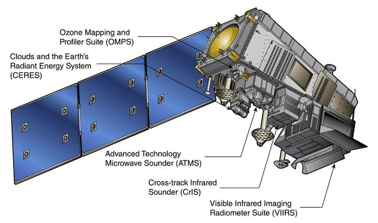
The Suomi NPP is the first in a new generation of satellites intended to replace the Earth Observing System satellites, which were launched from 1997 to 2011. The satellite orbits the Earth about 14 times each day. Its five imaging systems include: