
Airport type Private 12/30 6,975 2,126 Concrete Elevation 51 m | Elevation AMSL 166 ft / 51 m 6,975 2,126 Code NRC Owner Ames Research Center | |
 | ||
Address Crows Landing, CA 95313, USA Similar Fink Road Landfill, Patterson, Covanta Energy Corporati, Best Western Plus Villa, Modesto City–Cou Airport | ||
Teamrev mtrally ralliart aas nasa crows landing airport 04jul2015
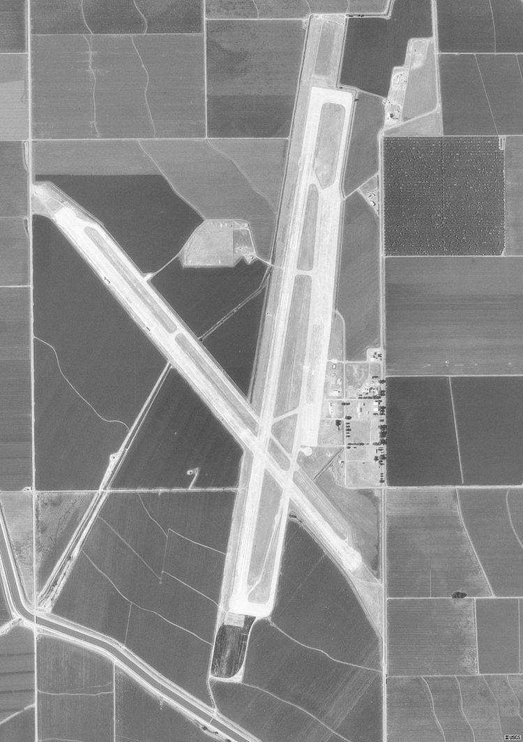
NASA Crows Landing Airport (IATA: NRC, ICAO: KNRC, FAA LID: NRC) is a private use airport that is owned by the NASA Ames Research Center, 1 nautical mile (1.9 km; 1.2 mi) northwest of the central business district of Crows Landing, in Stanislaus County, California. The airfield was formerly named Naval Auxiliary Landing Field Crows Landing or NALF Crows Landing when operated by the U.S. Navy. As of January 2011 Airport-data.com reports this airport status as Closed Permanently.
Contents
- Teamrev mtrally ralliart aas nasa crows landing airport 04jul2015
- Facilities
- Mare Island Studios
- References
Facilities
The airport has two runways with concrete surfaces: 12/30 is 6,975 by 200 ft (2,126 by 61 m), and 17/35 is 7,950 by 200 ft (2,423 by 61 m).
Mare Island Studios
Mare Island Studios is exploring the possibility of using the site for a new large Northern California location that could create three- to five-thousand jobs for the area.