
Adm. region Mittelfranken Vehicle registration LAU, ESB, HEB, N, PEG Area 800.1 km² | Time zone CET (UTC+1) Website nuernberger-land.de | |
 | ||
Points of interest Rothenberg Fortress, Burg Veldenstein, Hohenstein Castle, Schwarzach, Industriemuseum Lauf Destinations | ||
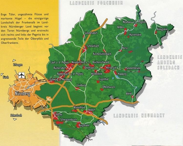
Nürnberger Land is a district in Bavaria, Germany. It is bounded by (from the north and clockwise) the districts of Forchheim, Bayreuth, Amberg-Sulzbach, Neumarkt, Roth and Erlangen-Höchstadt, and by the city of Nuremberg.
Contents
Map of N%C3%BCrnberger Land, Germany
History
The district was established in 1972 by merging the former districts of Nuremberg, Hersbruck and Lauf, reuniting for the first time since 1789 most of the former lands of the Imperial City of Nuremberg.
Geography
The district includes the eastern metropolitan area of Nuremberg in the west and the hills of the Frankish Alb in the east. The Pegnitz River runs through the district, coming from the northeast and leaving to the west towards Nuremberg.
References
Nürnberger Land Wikipedia(Text) CC BY-SA