
Established 1999 Time zone ACST (UTC+9:30) Mean max temp Mean min temp | Postcode(s) 5202 State electorate(s) Finniss Postal code 5202 | |
 | ||
Myponga Beach is a locality in the Australian state of South Australia located on the west coast of the Fleurieu Peninsula overlooking Gulf St Vincent about 54 kilometres (34 mi) south of the state capital of Adelaide.
Map of Myponga Beach SA 5202, Australia
Myponga Beach originally began as a shack site on section 240 in the cadastral unit of the Hundred of Myponga. Boundaries were created for the “long established name” in 1999.
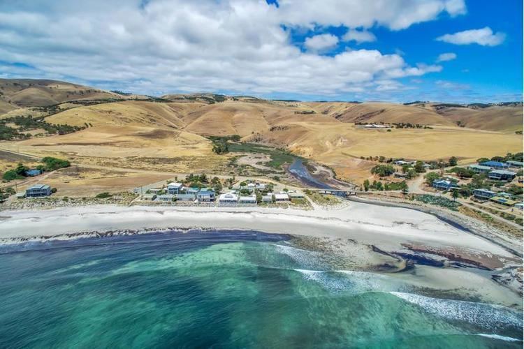
Myponga Beach consists of land associated with a section of coastline overlooking Gulf St Vincent that extends from Carrickalinga Point to the south end of Aldinga Bay in the north. The coastline including an inlet known as Coweelunga Bay which includes the mouth of the Myponga River and whose southern headland is the southern extremity of Aldinga Bay. A settlement formerly known as the Myponga Beach Shack Site is located on the shore of Coweelunga Bay.
As of 2015, land use within the locality consists of land zoned for primary production uses such as agriculture, land adjoining the coastline being zoned for conservation purposes and the settlement at Coweelunga Bay being zoned as a ‘country township’.
Myponga Beach is located within the federal division of Mayo, the state electoral district of Finniss and the local government area of the District Council of Yankalilla.