Population 41,214 (2011 census) | Area 8 km² | |
 | ||
Abolished 12 May 2016 (2016-05-12) | ||
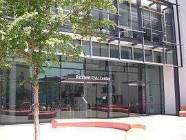
The Municipality of Ashfield was a local government area in the Inner West of Sydney, New South Wales, Australia. It is about 10 kilometres (6.2 mi) west of the Sydney central business district.
Contents
- Map of Ashfield NSW Australia
- Suburbs
- Demographics
- Current composition and election method
- List of past mayors
- References
Map of Ashfield, NSW, Australia
The Mayor of the Municipality was Cr. Lucille McKenna, a Labor politician.
A 2015 review of local government boundaries recommended that the Municipality of Ashfield merge with the Municipality of Leichhardt and the Marrickville Council to form a new council with an area of 35 square kilometres (14 sq mi) and support a population of approximately 186,000. On 12 May 2016, Ashfield merged with Marrickville Council and the Municipality of Leichhardt to form the Inner West Council.
Suburbs
The municipality comprises:
It also includes parts of:
Demographics
At the 2011 Census, there were 41,214 people in the Ashfield local government area, of these 48.6% were male and 51.4% were female. Aboriginal and Torres Strait Islander people made up 0.6% of the population. The median age of people in the Municipality of Ashfield was 37 years. Children aged 0 – 14 years made up 15.1% of the population and people aged 65 years and over made up 14.4% of the population. Of people in the area aged 15 years and over, 45.1% were married and 10.0% were either divorced or separated.
Population growth in The Municipality of Ashfield between the 2001 Census and the 2006 Census was 1.76%; while in the subsequent five years to the 2011 Census, population growth was 3.90%. When compared with total population growth of Australia for the same periods, being 5.78% and 8.32% respectively, population growth in Ashfield local government area was significantly less than the national average. The median weekly income for residents within the Municipality of Ashfield of was generally on par with the national average.
At the 2011 Census, the proportion of residents in Ashfield local government area who stated their ancestry as Chinese was in excess of four times the state and national averages; and the proportion of households where an Asian language was spoken at home was about six times higher than the national average.
Current composition and election method
Ashfield Municipal Council was composed of twelve Councillors elected proportionally as four separate wards, each electing three Councillors. All Councillors were elected for a fixed four-year term of office. The Mayor was elected by the Councillors at the first meeting of the Council. The most recent and last election was held on 30 September 2013, and the makeup of the Council was as follows:
The last Council, elected in 2012 and abolished in 2016, in order of election by ward, was:
List of past mayors
The full list of mayors since 1872 can be found here.
