
Population 10,742 (2011 census) Postcode(s) 2133 Founded 1914 Local time Monday 9:03 AM | Established 1914 Postal code 2133 | |
 | ||
LGA(s) Canterbury-Bankstown CouncilBurwood CouncilInner West Council Weather 21°C, Wind SW at 29 km/h, 70% Humidity | ||
Croydon Park is a suburb in the Inner West of Sydney, in the state of New South Wales, Australia. Croydon Park is about 12 kilometres south-west of the Sydney central business district and is divided between the local government areas of the Canterbury-Bankstown Council, Burwood Council and Inner West Council. Croydon is a separate suburb, to the north.
Contents
- Map of Croydon Park NSW 2133 Australia
- History
- Transport
- Schools
- Parks
- Demographics
- Notable residents
- Politics
- References
Map of Croydon Park NSW 2133, Australia
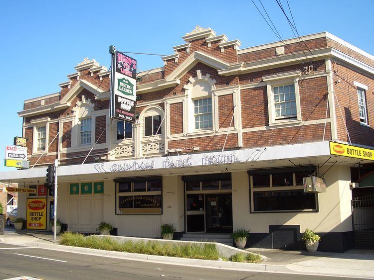
Croydon Park has a thriving commercial area along Georges River Road and is close to larger shopping areas in Burwood, Ashfield and Campsie. Croydon Park is a small residential suburb with many stores, particularly family owned such as Saba Hair Design, La Bocca Deli Cafe, Shisha Bar and Grill, Pure Gelato, Maranello's Veloce Italian Pizzeria, Renee's Pizzeria, Abla's pastry, ANAR Lebanese Charcoal Chicken, Little Thailand, Domino's, McDonald's, Subway, TAB, IGA, Croydon Park Chinese Restaurant, Croydon Park Petroleum, Croydon Park Hotel.
History
Croydon Park was originally part of the territory of the Darug tribe which occupied much of Sydney. More specifically, it was probably home to the Wangal clan (based around Concord) but may also have been home to the Cadigal (Sydney) or Bideagal (Botany Bay) clans. There were middens along the Cooks River where the indigenous people camped. These were destroyed by early British settlers to make lime for mortar in buildings.
In 1878 and 1880, following the building of a railway station at Croydon to the north, two large subdivisions of land were undertaken using the name Croydon Park. These constituted the entire area of the current suburb. A piece of flood-prone land at the junction of Croydon Avenue and the Cooks River was reserved as a public park. Given the name Croydon Park, it was the first reserve in the City of Canterbury. Early settlers included many people involved in the building trade and Chinese market gardeners.
A primary school was established in 1886 to cater for the increasing number of children in the area. Mains water was connected in 1889 and sewerage in the 1910s. The Parents and Citizens Association at the public school believed that residents were rather left out of regular postal deliveries and a petition was prepared for their member of parliament asking for a Croydon Park post office to be opened in the area. They were successful in 1914 and the surrounding neighbourhood became a separate suburb.
Circa 1890, the mansion But-har-gra was built on Georges River Road, probably by a local notable. A substantial two-storey house of brick, it combines Italianate and Federation elements. It is currently used as residential accommodation for students of Moore Theological College and is heritage-listed.
Transport
There is no railway station at Croydon Park, but it is well serviced by buses to neighbouring stations. The 413 is the most significant service connecting to both the city and Campsie. The 400 is also a major orbital bus route travelling from Burwood to Bondi Junction via Croydon Park, Campsie, Rockdale, Sydney Airport and Eastgardens. Other services include:
There is also a cycleway along the Cooks River connecting Olympic Park at Homebush with Botany Bay.
Schools
There are two primary schools in Croydon Park: Croydon Park Public School and St Francis Xavier's Catholic School.
Parks
Croydon Park, commonly mistaken for Croydon, boasts numerous parks and parklands, particularly close to the Cooks River. Picken Oval is home to the Western Suburbs Magpies Australian Rules team and is currently under redevelopment. Lees Park is a homeground of Canterbury Junior Soccer Association. Other parks and reserves include Flockhart Park, Rosedale Reserve and Croydon Park.
Demographics
According to the 2011 census, Croydon Park had a population of 10,742. In Croydon Park, 56.6% of people were born in Australia. The most common other countries of birth were Italy 5.5%, China 5.3%, Lebanon 3.3%, New Zealand 1.6% and Korea, Republic of (South) 1.5%. More than half of residents spoke a language other than English at home, with the top languages being Italian 10.0%, Arabic 7.6%, Mandarin 4.8%, Cantonese 4.0% and Greek 3.9%. The most common responses for religion in Croydon Park in the 2011 Census were Catholic 43.9%, No Religion 14.4%, Anglican 8.8%, Eastern Orthodox 7.6% and Buddhism 3.4%.
Notable residents
Politics
Croydon Park is divided between three local government areas and as a result is frequently divided between different state and federal electorates as well. Since the 2010 federal election, it has been wholly within the division of Watson, represented by Tony Burke. The whole suburb is currently within the state electoral district of Strathfield, represented by Jodi McKay since 2015.