
OSI/OSNI grid H5180 Elevation 542 m Province Ulster | Topo map OSNI Discoverer 13 Prominence 378 m Listing Marilyn | |
 | ||
Similar Mullagh - County Londonderry, Bel Mountain, Lougher, Aghla Beg, Sawel Mountain | ||
Project mountain goat final summit mullaghcarn
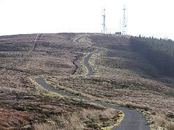
Mullaghcarn (from Irish: Mullach Cairn, meaning "peak of the cairns") is a mountain in the southwest Sperrins, County Tyrone, Northern Ireland. The peak reaches a height of 542 m (1778 ft), and is the 370th highest in Ireland. Mullaghcarn is in Omagh District Council, on the edge of Gortin Glen Forest Park, and is the most southerly peak in the Sperrins. It is 5 miles (8.0 km) northeast of Omagh, and is 3.1 miles (5.0 km) south of Gortin.
Contents
- Project mountain goat final summit mullaghcarn
- Map of Mullaghcarn Omagh UK
- Last sunday in july cairn sunday mullaghcarn mountain
- Nature
- History
- References
Map of Mullaghcarn, Omagh, UK
Last sunday in july cairn sunday mullaghcarn mountain
Nature
Mullaghcarn is steep, and has a rocky summit. The west of the mountain is home to conifers. "Acid" grassland is the most common on Mullaghcarn, and peat is not especially common, due to the draining of the eastern mountain. Heather is most common on the northern slopes. The Red Grouse can be found on heathland around Mullaghcarn.
History
Mullaghcarn was home to firing ranges during World War II. These were used by the police and US Army soldiers stationed in the area.