
431806 431806 Elevation 371 m Local time Tuesday 9:35 AM | Time zone IST (UTC+5:30) Vehicle registration MH-26 Population 23,517 (2011) | |
 | ||
Weather 30°C, Wind E at 10 km/h, 32% Humidity | ||
Mudkhed is a city and a municipal council in Nanded District in the Indian state of Maharashtra.
Contents
Map of Mudkhed, Maharashtra 431806
Transport
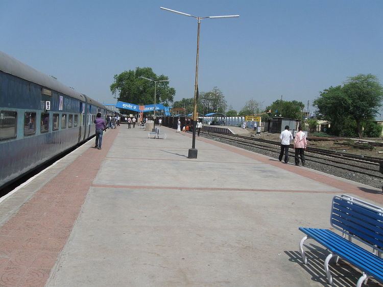
Mudkhed Junction as in 2010 is the junction of three railway lines. A Broad gauge line goes to Parbhani, a Broad gauge line to be goes to Nagpur, and another broad gauge line goes to Secunderabad.
Mudked is located 24 km (15 mi) towards east from district headquarters Nanded. 571 km (355 mi) from State capital Mumbai towards west.
CRPF center Mudkhed was established in September 1996 by Shankarrao Chavan.
Mudkhed Taluka
Mudkhed taluka consist of 65 Villages and 51 Panchayats. Amrapur (Dudhanwadi) is the smallest Village and Barad is the biggest Village. More than 100,000 people living in 16,586 Houses in Mudkhed taluka of 65 villages while Mudkhed town has around 25,000 population.