
Country United States Time zone Eastern (EST) (UTC-5) Area 10.49 km² Population 6,808 (2013) Area code 908 | Incorporated September 25, 1895 Elevation 71 m Zip code 07092 Local time Monday 8:42 AM | |
 | ||
Area rank 296th of 566 in state12th of 21 in county Weather -2°C, Wind NW at 8 km/h, 69% Humidity Points of interest Watchung Reservation, Echo Lake Park, Trailside Nature & Science, Lake Surprise, Deacon Andrew Hetfield H | ||
Mountainside is a borough in Union County, New Jersey, United States. As of the 2010 United States Census, the borough's population was 6,685, reflecting an increase of 83 (+1.3%) from the 6,602 counted in the 2000 Census, which had in turn declined by 55 (-0.8%) from the 6,657 counted in the 1990 Census.
Contents
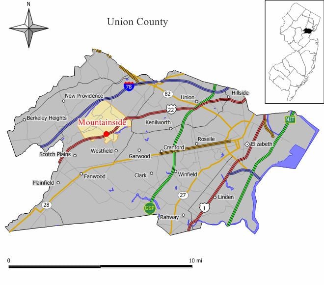
- Map of Mountainside NJ 07092 USA
- History
- Geography
- Census 2010
- Census 2000
- Local government
- Federal state and county representation
- Politics
- Education
- Emergency medical services
- Roads and highways
- Public transportation
- Notable people
- References
Map of Mountainside, NJ 07092, USA
Mountainside was incorporated as a borough on September 25, 1895, from portions of Westfield Township, based on the results of a referendum held the previous day.
New Jersey Monthly magazine ranked Mountainside as its 16th best place to live in its 2008 rankings of the "Best Places To Live" in New Jersey, as well as eighth in the 2010 list.
History
In 1958, part of a Nike missile battery (NY-73) was installed, with the missile launchers themselves in Mountainside while the radar station was installed in Berkeley Heights. It remained in operation until 1963 and remnants of the site are located adjacent to Governor Livingston High School.
Geography
According to the United States Census Bureau, the borough had a total area of 4.0497 square miles (10.487 km2), including 4.008 square miles (10.380 km2) of land and 0.041 square miles (0.107 km2) of water (1.02%).
The borough is bordered to the north by Summit, to the east by Springfield Township, to the south by Westfield, and to the west by Berkeley Heights and Scotch Plains.
Census 2010
The 2010 United States Census counted 6,685 people, 2,468 households, and 1,866 families residing in the borough. The population density was 1,668.0 per square mile (644.0/km2). The borough contained 2,558 housing units at an average density of 638.3 per square mile (246.4/km2). The racial makeup of the borough was 91.31% (6,104) White, 1.97% (132) Black or African American, 0.00% (0) Native American, 4.94% (330) Asian, 0.00% (0) Pacific Islander, 0.42% (28) from other races, and 1.36% (91) from two or more races. Hispanics or Latinos of any race were 6.09% (407) of the population.
Out of a total of 2,468 households, 30.8% had children under the age of 18 living with them, 66.7% were married couples living together, 6.5% had a female householder with no husband present, and 24.4% were non-families. 21.6% of all households were made up of individuals, and 15.6% had someone living alone who was 65 years of age or older. The average household size was 2.64 and the average family size was 3.10.
In the borough, 23.2% of the population were under the age of 18, 4.8% from 18 to 24, 18.2% from 25 to 44, 30.0% from 45 to 64, and 23.7% who were 65 years of age or older. The median age was 47.2 years. For every 100 females the census counted 92.7 males, but for 100 females at least 18 years old, it was 88.1 males.
The Census Bureau's 2006-2010 American Community Survey showed that (in 2010 inflation-adjusted dollars) median household income was $116,210 (with a margin of error of +/- $22,182) and the median family income was $135,086 (+/- $14,679). Males had a median income of $95,030 (+/- $9,312) versus $58,818 (+/- $8,974) for females. The per capita income for the borough was $52,844 (+/- $5,530). About 1.5% of families and 3.5% of the population were below the poverty line, including 3.1% of those under age 18 and 8.1% of those age 65 or over.
Census 2000
As of the 2000 United States Census there were 6,602 people, 2,434 households, and 1,925 families residing in the borough. The population density was 1,640.8 people per square mile (634.1/km2). There were 2,478 housing units at an average density of 615.8 per square mile (238.0/km2). The racial makeup of the borough was 95.09% White, 0.94% African American, 0.09% Native American, 2.80% Asian, 0.06% Pacific Islander, 0.27% from other races, and 0.74% from two or more races. Hispanic or Latino of any race were 3.01% of the population.
There were 2,434 households out of which 29.3% had children under the age of 18 living with them, 71.9% were married couples living together, 5.3% had a female householder with no husband present, and 20.9% were non-families. 17.9% of all households were made up of individuals and 11.9% had someone living alone who was 65 years of age or older. The average household size was 2.60 and the average family size was 2.95.
In the borough the population was spread out with 21.1% under the age of 18, 3.8% from 18 to 24, 22.9% from 25 to 44, 27.3% from 45 to 64, and 24.9% who were 65 years of age or older. The median age was 46 years. For every 100 females there were 89.2 males. For every 100 females age 18 and over, there were 87.1 males.
The median income for a household in the borough was $97,195, and the median income for a family was $105,773. Males had a median income of $78,595 versus $52,667 for females. The per capita income for the borough was $47,474. About 2.0% of families and 3.0% of the population were below the poverty line, including 1.9% of those under age 18 and 2.9% of those age 65 or over.
Local government
Mountainside is governed by a Mayor-Council form of government as authorized through the Option Municipal Charter Law (commonly called the Faulkner Act). Under this form of local government, a Mayor is elected for a term of four years and there is a Borough Council consisting of six members, each elected for three-year terms, with two seats coming up for election each year in a three-year cycle. Both the Mayor and Borough Council are elected at-large, that is, to represent the entire community. Elections for all officials in Mountainside Borough are conducted on a partisan basis during the November General Election.
As of 2016, the mayor of Mountainside is Republican Paul N. Mirabelli, whose term of office ends on December 31, 2019. Members of the Borough Council are Council President Keith C. Turner (R, 2017), Deanna Andre (R, 2017), René Dierkes (R, 2016), Wendy Fech-Caccamo (R, 2018), Robert W. Messler (R, 2018) and Glenn W. Mortimer (R, 2016).
Federal, state and county representation
Mountainside is located in the 7th Congressional District and is part of New Jersey's 21st state legislative district.
New Jersey's Seventh Congressional District is represented by Leonard Lance (R, Clinton Township). New Jersey is represented in the United States Senate by Cory Booker (D, Newark, term ends 2021) and Bob Menendez (D, Paramus, 2019).
For the 2016–2017 session (Senate, General Assembly), the 21st Legislative District of the New Jersey Legislature is represented in the State Senate by Thomas Kean Jr. (R, Westfield) and in the General Assembly by Jon Bramnick (R, Westfield) and Nancy Munoz (R, Summit). The Governor of New Jersey is Chris Christie (R, Mendham Township). The Lieutenant Governor of New Jersey is Kim Guadagno (R, Monmouth Beach).
Union County is governed by a Board of Chosen Freeholders, whose nine members are elected at-large to three-year terms of office on a staggered basis with three seats coming up for election each year, with an appointed County Manager overseeing the day-to-day operations of the county. At an annual reorganization meeting held in the beginning of January, the board selects a Chairman and Vice Chairman from among its members. As of 2014, Union County's Freeholders are Chairman Christopher Hudak (D, Linden, term ends December 31, 2014), Vice Chairman Mohamed S. Jalloh (D, Roselle, 2015), Bruce Bergen (D, Springfield Township, 2015), Linda Carter (D, Plainfield, 2016), Angel G. Estrada (D, Elizabeth, 2014), Sergio Granados (D, Elizabeth, 2016) Bette Jane Kowalski (D, Cranford, 2016), Alexander Mirabella (D, Fanwood, 2015) and Vernell Wright (D, Union, 2014). Constitutional officers elected on a countywide basis are County Clerk Joanne Rajoppi (D, Union, 2015), Sheriff Ralph Froehlich (D, Union, 2016) and Surrogate James S. LaCorte (D, Springfield Township, 2014). The County Manager is Alfred Faella.
Politics
As of March 23, 2011, there were a total of 4,744 registered voters in Mountainside, of which 1,201 (25.3% vs. 41.8% countywide) were registered as Democrats, 1,568 (33.1% vs. 15.3%) were registered as Republicans and 1,974 (41.6% vs. 42.9%) were registered as Unaffiliated. There was one voter registered to another party. Among the borough's 2010 Census population, 71.0% (vs. 53.3% in Union County) were registered to vote, including 92.5% of those ages 18 and over (vs. 70.6% countywide).
In the 2012 presidential election, Republican Mitt Romney received 2,100 votes (59.2% vs. 32.3% countywide), ahead of Democrat Barack Obama with 1,401 votes (39.5% vs. 66.0%) and other candidates with 30 votes (0.8% vs. 0.8%), among the 3,548 ballots cast by the borough's 4,940 registered voters, for a turnout of 71.8% (vs. 68.8% in Union County). In the 2008 presidential election, Republican John McCain received 2,331 votes (60.0% vs. 35.2% countywide), ahead of Democrat Barack Obama with 1,500 votes (38.6% vs. 63.1%) and other candidates with 33 votes (0.8% vs. 0.9%), among the 3,888 ballots cast by the borough's 4,911 registered voters, for a turnout of 79.2% (vs. 74.7% in Union County). In the 2004 presidential election, Republican George W. Bush received 2,215 votes (58.0% vs. 40.3% countywide), ahead of Democrat John Kerry with 1,561 votes (40.8% vs. 58.3%) and other candidates with 31 votes (0.8% vs. 0.7%), among the 3,822 ballots cast by the borough's 4,796 registered voters, for a turnout of 79.7% (vs. 72.3% in the whole county).
In the 2013 gubernatorial election, Republican Chris Christie received 69.9% of the vote (1,595 cast), ahead of Democrat Barbara Buono with 29.0% (661 votes), and other candidates with 1.1% (26 votes), among the 2,320 ballots cast by the borough's 4,860 registered voters (38 ballots were spoiled), for a turnout of 47.7%. In the 2009 gubernatorial election, Republican Chris Christie received 1,754 votes (61.8% vs. 41.7% countywide), ahead of Democrat Jon Corzine with 842 votes (29.6% vs. 50.6%), Independent Chris Daggett with 204 votes (7.2% vs. 5.9%) and other candidates with 17 votes (0.6% vs. 0.8%), among the 2,840 ballots cast by the borough's 4,827 registered voters, yielding a 58.8% turnout (vs. 46.5% in the county).
Education
The Mountainside School District serves public school students in pre-kindergarten through eighth grade. As of the 2012-13 school year, the district's two schools had an enrollment of 777 students and 55.6 classroom teachers (on an FTE basis), for a student–teacher ratio of 13.98:1. Schools in the district (with 2012-13 enrollment data from the National Center for Education Statistics) are Beechwood School (grades PreK-2; 255 students) and Deerfield School (grades 3-8; 522 students).
Public school students in ninth through twelfth grades attend Governor Livingston High School in Berkeley Heights, as part of a sending/receiving relationship with the Berkeley Heights Public Schools. As of the 2013-14 school year, the high school had an enrollment of 1,006 students and 86.8 classroom teachers (on an FTE basis), for a student–teacher ratio of 11.6:1.
Students also have the choice to attend the programs of the Union County Vocational Technical Schools, which serve students from across Union County.
Emergency medical services
Emergency Medical Services for the borough of Mountainside is provided by the Mountainside Rescue Squad during nights and weekends. Weekday daytime coverage is provided by Atlantic Ambulance EMS. Atlantic Ambulance also has a paramedic unit stationed in Mountainside.
Roads and highways
As of May 2010, the borough had a total of 41.12 miles (66.18 km) of roadways, of which 29.74 miles (47.86 km) were maintained by the municipality, 8.75 miles (14.08 km) by Union County and 2.63 miles (4.23 km) by the New Jersey Department of Transportation.
Public transportation
NJ Transit Bus Operations routes 114 and 117 provide service to the Port Authority Bus Terminal in Midtown Manhattan in New York City while routes 65 and 66 travel to Downtown Newark, all making local stops at points in proximate communities. An early use of bus rapid transit in New Jersey, a BBS (bus bypass shoulder, originally called a BOS or bus on shoulder lane) has been in operation for many years. Unlike most municipalities along Route 22, zoning in Mountainside does not allow for much commercial development adjacent to the freeway. For a one-mile stretch in the town, the eastbound shoulder on the arterial road can be used for peak hour buses. In 2012, NJDOT regulated the BBS as an exclusive bus lane from 6 to 7:30am. In 2009, NJDOT funded construction of two bus turnouts along the road in nearby Union.
Newark Liberty International Airport is approximately 11 miles (18 km) east of Mountainside.
Notable people
People who were born in, residents of, or otherwise closely associated with Mountainside include: