
Age of rock 550 million years Elevation 3,544 m First ascent 1894 | Topo map NTS 82N/08 Easiest route Scramble (SW) Prominence 1,544 m | |
 | ||
Similar Mount Hungabee, Fairview Mountain, Mount Fay, Mount Athabasca, Mount Hector | ||
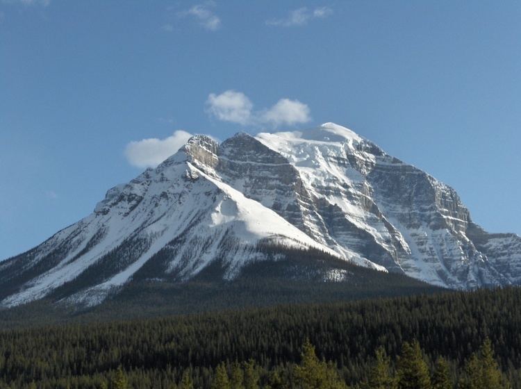
Mount Temple is a mountain in Banff National Park of the Canadian Rockies of Alberta, Canada.
Contents
- Map of Mount Temple Improvement District No 9 AB Canada
- History
- Tragedy
- Climbing routes
- First Ascent
- References
Map of Mount Temple, Improvement District No. 9, AB, Canada
Mt. Temple is located in the Bow River Valley between Paradise Creek and Moraine Creek and is the highest peak in the Lake Louise area. The peak dominates the western landscape along the Trans-Canada Highway from Castle Junction to Lake Louise.
History
The mountain was named by George Mercer Dawson in 1884 after Sir Richard Temple who visited the Canadian Rockies that same year. Mt. Temple was the first 11,000-foot (3,400 m) peak to be climbed in the Canadian segment of the Rocky Mountains.
Tragedy
Climbing routes
The mountain offers several routes for climbers and the normal route on the southwest side offers a moderate class scrambling route. See Scrambles in the Canadian Rockies for a description of that route. Climbers must be careful on this "easy" climb due to falling rock and if lost on the route, steep cliffs and avalanches.
Current route conditions can be obtained from a climbing warden at the park information centre in Lake Louise. A climber's log outside the centre may also provide comments from other climbers.