
Width 43 km (27 mi) Elevation 3,543 m | Length 34 km (21 mi) N-S Area 717 km² | |
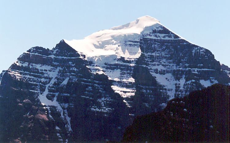 | ||
Mountains Mount Temple, Mount Hungabee, Mount Victoria, Mount Lefroy, Fairview Mountain | ||
The Bow Range is a mountain range of the Canadian Rockies in Alberta and British Columbia, Canada. The range is named in associated with the Bow River and was officially adopted on March 31, 1917 by the Geographic Board of Canada.
It is a part of the Banff-Lake Louise Core Area of the Southern Continental Ranges, located on the Continental Divide, west of the Bow River valley, in Banff National Park and Kootenay National Park.
The Bow Range covers a surface area of 717 km² (277 mi²), has a length of 34 km (from north to south) and a maximum width of 43 km. The highest peak is Mount Temple, with an elevation of 3,543 m (11,624 ft). The range also covers the Valley of the Ten Peaks, with the tallest of the ten being Deltaform mountain with an elevation of 3424 metres and the second highest being Mount Hungabee at 3493 metres. The range also has hiking areas such as the Consolation Lakes, Sentinel Pass-Larch Valley, Wenkchenma Pass-Eiffel Lake, the beehive plain of the Six Glaciers system and Saddle Back Pass.