
Elevation 3,492 m Prominence 987 m | Easiest route rock/snow climb First ascent 1903 | |
 | ||
Mountain range Canadian Rockies, Bow Range Similar Mount Forbes, Mount Brazeau, North Twin Peak, Mount Kitchener, Mount Clemenceau | ||
Mount hungabee time lapse
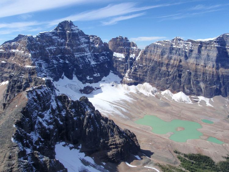
Mount Hungabee, officially Hungabee Mountain, is a mountain located on the boundaries of Banff National Park and Yoho National Park on the Continental Divide at the head of Paradise Valley. The peak was named in 1894 by Samuel Allen after the Stoney Indian (also known as Nakoda) word for "chieftain" as the mountain is higher than its neighbouring peaks. The mountain can be seen from the Icefields Parkway (#93) in the upper Bow Valley.
Contents
- Mount hungabee time lapse
- Map of Hungabee Mountain Improvement District No 9 AB Canada
- Routes
- References
Map of Hungabee Mountain, Improvement District No. 9, AB, Canada
Mt. Hungabee was first climbed in 1903 by H.C. Parker who was guided by Hans Kaufmann and Christian Kaufmann.
Routes
The normal climbing route is via the west ridge (III 5.4) which features route finding challenges. Early summer is not recommended due to avalanche hazard from snow on the NW face.
References
Mount Hungabee Wikipedia(Text) CC BY-SA