
Easiest route Hike | Elevation 1,380 m | |
 | ||
Similar Mount Giles, Mount Zeil, Mount Conner, Mount Liebig, Mount Woodroffe | ||
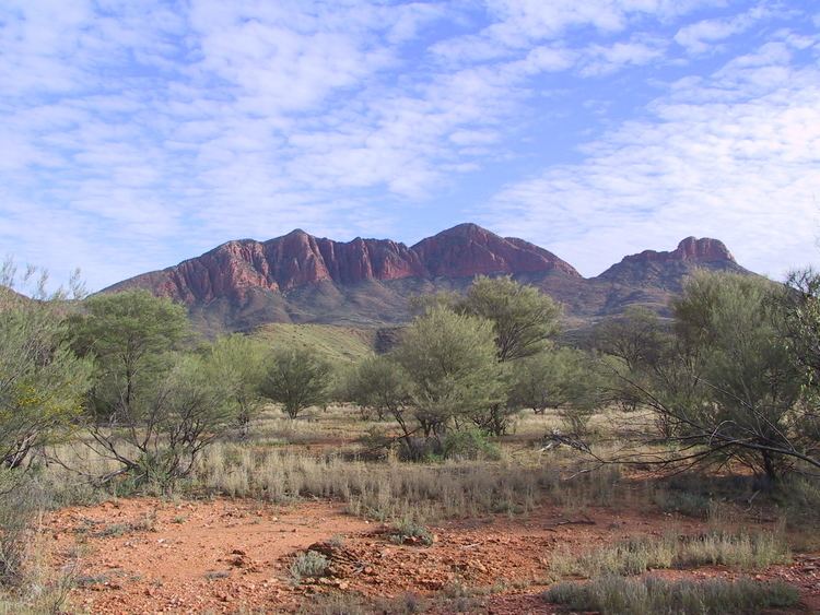
Sunrise on mount sonder
Mount Sonder, or Rwetyepme, its Aboriginal name, is the fourth highest mountain in the Northern Territory, Australia at 1380 metres above sea level. Mount Zeil is the highest at 1531 metres, 27 kilometres to the west. It is 130 km (81 mi) west of Alice Springs along the MacDonnell Ranges in the West MacDonnell National Park. It marks one end of the celebrated Larapinta trail, which extends 223 kilometres to Alice Springs. The shape of the mountain is a double peak, the relative heights of which are somewhat ambiguous from the summit, although easy to identify from the surrounding plains. The mountain can be seen from the western half of the Larapinta trail, up to Ormiston Pound, which obscures it from then on.
Contents
- Sunrise on mount sonder
- Map of Mount Sonder Mount Zeil NT 0872 Australia
- Morning on mount sonder
- References
Map of Mount Sonder, Mount Zeil NT 0872, Australia
Explorer Ernest Giles named the mountain in honour of German botanist Dr. Otto Wilhelm Sonder.
A clearly defined walking track exists up the western side, taking about 12 kilometres. Water is available from a water tank 50 m beyond the carpark, and a direction plate can be found at the summit. This however is not the true summit, which is 750m away, but has been chosen for safety reasons. The view from the top boasts the taller Mount Zeil to the west, the West MacDonnell Range to the east, Glen Helen, a nearby resort, to the east and Gosses Bluff to the south west on a clear day.