
Easiest route Hike | Elevation 1,389 m | |
 | ||
Similar Mount Sonder, Mount Zeil, The Acropolis, Mount Cobbler, Mount Geryon | ||
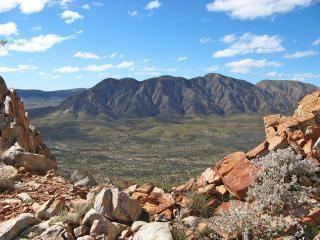
Mount Giles is one of the highest mountains in the Northern Territory, Australia, at 1389 metres AHD. It lies along the MacDonnell Ranges, dominating Ormiston Pound, in the West MacDonnell National Park, approximately 80 kilometres west of Alice Springs. It can be visited via the celebrated Larapinta Trail and offers spectacular views of Mount Sonder, Ormiston Gorge and Pound, and the surrounding range.
Map of Mount Giles, Burt Plain NT 0872, Australia
Climbing the mountain requires a hard two- or three-day hike.
References
Mount Giles Wikipedia(Text) CC BY-SA