
Isolation 5.19 mi (8.36 km) Elevation 4,327 m Prominence 657 m | Easiest route Hike First ascent 17 July 1877 | |
 | ||
Listing North America highest peaks 46thUS highest major peaks 32ndColorado highest major peaks 15thColorado fourteeners 18th Topo map USGS 7.5' topographic mapMount Antero, Colorado Similar Mount Yale, Mount Antero, Mount Harvard, Mount Shavano, La Plata Peak | ||
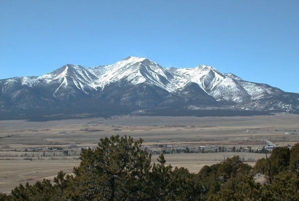
Mount Princeton is a high and prominent mountain summit of the Collegiate Peaks in the Sawatch Range of the Rocky Mountains of North America. The 14,197 feet (4,327 m) fourteener is located in San Isabel National Forest, 7.8 miles (12.6 km) southwest (bearing 225°) of the Town of Buena Vista in Chaffee County, Colorado, United States. The mountain was named in honor of Princeton University.
Contents
Map of Mt Princeton, Colorado 81236, USA
MountainEdit
While not one of the highest peaks of the Sawatch Range, Mount Princeton is one of the most dramatic, abruptly rising nearly 7,000 feet above the Arkansas River valley in only 6 miles.
The first recorded ascent was on July 17, 1877, at 12:30 pm by William Libbey of Princeton University. It is likely that various miners had climbed the peak earlier. The name Mount Princeton was in use as early as 1873, and the peak was most likely named by Henry Gannett, a Harvard graduate and chief topographer in a government survey led by George M. Wheeler.