
Last eruption 2008 Mountain range Akan Volcanic Complex | Volcanic arc/belt Kuril arc Elevation 1,370 m Parent range Akan Volcanic Complex | |
 | ||
Topo map Geographical Survey Institute 25000:1 雄阿寒岳50000:1 阿寒湖 Similar Mount Meakan, Mt Akan‑Fuji, Mount Kamui, Mount Shari, Mount Rausu | ||
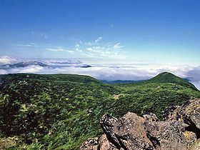
Mount Oakan (雄阿寒岳, Oakan-dake) is a shield volcano located in Akan National Park in Hokkaidō, Japan.
Contents
Map of Mount Oakan, Kushiro, Hokkaido Prefecture, Japan
Geography and geologyEdit
Mount Oakan sits in the Akan caldera northeast of Lake Akan. The volcano rises some 900 metres (3,000 ft) above the surrounding terrain. The top of the volcano is 1,370 metres (4,490 ft) above sea level. The volcanic cone is some 8 kilometres (5.0 mi) in diameter. There are three explosion craters at the summit. At Kitanakahara (北中腹) at about 800 metres (2,600 ft), there is a fumarole. The volcano is made mostly from non-alkalai mafic volcanic rock. The main rock type is andesite and dacite.
HistoryEdit
Mount Oakan emerged in the Late Pleistocene dropping pumice on Minamishikata. After that, continuous lava flows formed the bulk of the volcano. In the final stages of its life, a parasitic volcano formed a lava dome at the summit.
According to its name and local legend, Mount Oakan is the male counterpart to Mount Meakan on the other side of Lake Akan.