Mount Banahaw, Mount Arayat, Mount Apo, Taal Volcano, Mayon
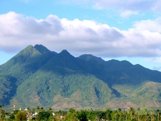
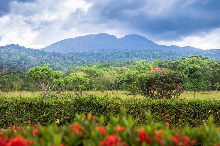
Mount Makiling, or Mount Maquiling, is a dormant volcano in Laguna Province on the island of Luzon, Philippines. The mountain rises to an Elevation of 1,090 m (3,580 ft) above mean sea level and is the highest feature of the Laguna Volcanic Field. The volcano has no recorded historic eruption but volcanism is still evident through geothermal features like mud spring and hot springs. South of the mountain is the Makiling-Banahaw Geothermal Plant. The Philippine Institute of Volcanology and Seismology (PHIVOLCS) classifies the volcano as potentially active.
Map of Mount Makiling, Los Ba%C3%B1os, Laguna, Philippines
Mount Makiling is a state-owned forest reserve administered by the University of the Philippines Los Baños. Prior its transfer to the university, the mountain was the first national park of the Philippines. Mount Makiling National Park was established on February 23, 1933 by Proclamation No. 552. However, it was decommissioned as a national park on June 20, 1963 by Republic Act no. 3523 when it was transferred to the University for use in forestry education and information.
Now known as Mount Makiling Forest Reserve, it was declared an ASEAN Heritage Park in 2013.
Mount makiling nature at its finest hq
LegendEdit
Legends surrounding the mountain relates to Maria Makiling, which is said to be the 'guardian' of the mountain. The contour of the mountain is said to be that of her in a reclining position.
History
The following are the proclamations, republic acts, and executive orders relevant to the Makiling Forest Reserve (MFR):
Proclamation No. 106 (1910) - Makiling Forest Reserve was established with specific boundaries and placed under the Bureau of Forestry by Governor General W. Cameron Forbes to regulate the use of public forest and forest reserves in the Philippines; Makiling Forest Reserve was set aside for the purpose of establishing a forest school and for silvicultural studies.
Proclamation No. 60 (1920) - The reserved was renamed Makiling National Botanic Gardens and placed under the Bureau of Forestry by Proclamation NO. 60 issued by Governor General Francis B. Harrison primary for scientific studies on plants and animals.
Proclamation No. 552 (1933) - The reserved was renamed the Makiling National Park under the Bureau of Forestry issued by Governor-General Theodore Roosevelt, Jr. to serve as game refuge and for other purposes for the benefit and enjoyment of the people.
Proclamation No. 214 (1937) - Calamba Estate block was added to the Park for forest purposes issued by President Manuel L. Quezon.
Republic Act (RA) 826 (1952) - Transfer of the administration of the Makiling National Park form the Bureau of Forestry to the Commission of Parks and Wildlife in order to promote effectual planning, development, maintenance and conservation of all national parks, monuments and wildlife in the country.
Proclamation No. 692 (1960) - Administration of the Makiling National Park was transferred from the Commission of Parks and Wildlife to the University of the Philippines (UP) issued by President Carlos P. Garcia for forestry education and research purposes of the College of Forestry, subject to the condition that said land will be conserved and preserved as a national park.
Republic Act (RA) 3523 (1963) - The Makiling National park was disestablished and then ceded, transferred and conveyed to UP issued by Pres. Diosdado Macapagal to serve as the land resource for carrying out a program of public education and information in forestry, with end goal of promoting general public appreciation of forest values.
Executive Order (EO) 224 (1987) - Complete jurisdiction, control and regulation of watershed areas including the Makiling Forest Reserve was given to the National Power Corporation (NPC) issued by President Corazon C. Aquino in support of the country’s major program of energy development.
Republic Act (RA) 6967 (1990) - Administration of the Makiling Forest Reserve was finally transferred to UPLB by President Corazon C. Aquino primarily as a training laboratory for the advancement of scientific and technical knowledge on the preservation, conservation and development of forest, flora and fauna and natural resources.
Executive Order 121 (1994) - created a Presidential Commission on Laguna Lake and Mt. Makiling Development to address urgent problems affecting the resources and to formulate a master plan for the development of the lake and the reserve which are seen as integrated ecosystems.
Pook ni Maria Makiling, an eco-tourism site adjacent to the Jamboree Site, National Arts Center and U.P. Los Baños
University of the Philippines, Los Baños
The CCF Mt. Makiling Recreation Center (known as MMRC), is a Christian recreation camp and retreat center owned by CCF and operated by RHI, located at Santo Tomas, Batangas on the slopes of Mt. Makiling. It is the prayer mountain and retreat center of Christ's Commission Fellowship.
Hiking activityEdit
Mt. Makiling is a favored destination for hikers, featuring two primary trails originating from the UPLB College of Forestry and Barangay San Miguel in Santo Tomas. The trail from UPLB is the more frequently traversed route, typically requiring 4–5 hours to ascend to the summit (Peak 2). This path was temporarily closed in October 2007 due to damage caused by Typhoon Xangsane in September 2006. It faced another closure in December 2012 following the discovery of two drowned students in a prohibited area of the mountain. The trail was re-opened most recently in March 2013. The second trail, known as Maktrav, starts in Santo Tomas. This route is more difficult and requires 6–7 hours to reach the summit. Both trails are generally established and safe, although throughout the years there have been occasional reports of fatal accidents and injuries, especially on the Santo Tomas side. Climbers also frequently encounter leeches along the way.