
Topo map USGS Independence Lake Prominence 630 m Parent range Sierra Nevada | Elevation 2,788 m Mountain range Sierra Nevada | |
 | ||
Similar Castle Peak, Mount Ingalls, Freel Peak, Sonora Peak, Salmon Mountain | ||
Mount Lola is a mountain in the Sierra Nevada of California. Its summit, located north of Donner Pass and Interstate 80, is the highest point in Nevada County. A subsidiary peak 1.2 miles (1.9 km) north of the main summit is highest point in Sierra County at 8,848 feet (2,697 m).
Map of Mt Lola, California, USA
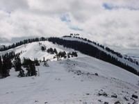
The area receives copious snowfall during the winter because of its high elevation.
The Mount Lola is named for Lola Montez, a famous resident of Nevada County, who lived in Grass Valley in the 1850s.
References
Mount Lola Wikipedia(Text) CC BY-SA