
Prominence 306 m Mountain range Sierra Nevada Parent range Sierra Nevada | Elevation 4,248 m | |
 | ||
Listing SPS Mountaineers peakWestern States Climbers Star peak First ascent July 1925 by Norman Clyde Easiest route Exposed scramble, class 3 Similar Mount Mallory, Mount McAdie, Table Mountain, Mount Whitney, Milestone Mountain | ||
Mount Le Conte (or LeConte) is a mountain located in the Sierra Nevada of California. The boundary between Inyo and Tulare counties runs along the crest of the Sierra, across Mount Le Conte. The mountain was named in 1895 for Joseph Le Conte (1823–1901), the first professor of geology and natural history at the University of California.
Contents
Map of Mt Le Conte, California, USA
GeographyEdit
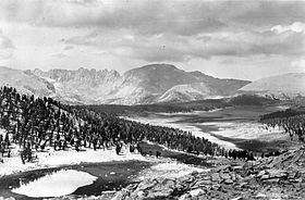
Mount Le Conte is about 3.5 miles (5.6 km) southeast of Mount Whitney, and is flanked to the northwest by Mount Mallory, and to the southeast by Mount Corcoran.
The southwest side of Mount Le Conte drains into Rock Creek, thence into the Kern River, which ends in the Central Valley of California. The north side of Mount Le Conte drains into Meysan Creek, thence into Lone Pine Creek, which ends in the Owens Valley. The east side of Le Conte drains into Tuttle Creek, and thence into Diaz Lake in the Owens Valley.
The southwest side is in Sequoia National Park while the north and east is in the John Muir Wilderness of the Inyo National Forest. The Pacific Crest Trail enters the park from the south at Siberian Pass about 5 miles (8.0 km) south of Mount Le Conte, and runs through the park a few miles west of the Sierra Crest.