
Elevation 857 m | Last eruption 970 AD ± 100 years Easiest route Hiking | |
 | ||
Translation mountain of the gods (Ainu) Topo map Geographical Survey Institute 25000:1 摩周湖南部, 50000:1 摩周湖 Parent range Daisetsuzan Volcanic Group Similar Mount Oakan, Mount Iō, Mount Shari, Mount Meakan, Mt Akan‑Fuji | ||
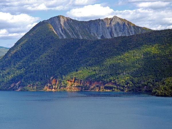
Mount Kamui (カムイヌプリ, Kamui-nupuri ), also Kamuinupuri or Mount Mashū, a potentially active volcano, is a parasitic stratovolcano of the Mashū caldera (itself originally a parasitic cone of Lake Kussharo) located in the Akan National Park of Hokkaido, Japan.
Contents
Map of Mount Kamui, Teshikaga, Kawakami District, Hokkaido Prefecture, Japan
Volcanism
Mount Kamui rose on the rim of 6 km-wide Mashū caldera, about four thousand years ago, after the collapse of Mashū volcano. Its last eruption took place about 1000 years ago.
Tourism
Hikers can follow a 7.2 km wooded trail to the peak of the mountain, walking along the ridge of the caldera, which is a 300-m vertical drop to the surface of the Lake Mashū, offering spectacular views.
References
Mount Kamui (Lake Mashū caldera) Wikipedia(Text) CC BY-SA