
Easiest route Scramble Prominence 90 m | First ascent Unknown Elevation 1,090 m | |
 | ||
Similar Mount Roberts, Denali, Devils Paw, Waddington Range, Mount Waddington | ||
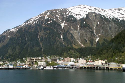
Mount Juneau is a 3,576-foot (1,090 m) massif in Southeast Alaska just one and a half miles east of downtown Juneau, Alaska, in the Boundary Ranges.
Contents
Map of Mt Juneau, Juneau, AK 99801, USA
HistoryEdit
Mount Juneau is steeped in mining history. Originally named Gold Mountain in 1881 by miners, it was also named Bald Mountain in roughly 1896. The name "Juneau Mountain" was first used in the mining records by Pierre "French Pete" Erussard when he located mining claims on the mountain in 1888.
In 1976, it was proposed by Chuck Keen of Alaska Trams (later to become Mount Juneau Enterprises) that a jigback aerial tramway be built to the top of the mountain. The venture never reached fruition although Goldbelt Inc. did end up building Mount Roberts Tramway to the neighboring Mount Roberts.
WeatherEdit
Mount Juneau receives an estimated 300% more rain than downtown Juneau (which receives 91 inches per year on average).
During winter, Mount Juneau is one of the preeminent avalanche threats to a major population center.
AccessEdit
The trail to Mount Juneau's summit can be accessed via the Perseverance Trail about one mile in from the trailhead. The trail features an assortment of alpine views as well although it traverses many steep slopes and caution is prudent in wet or snowy weather.