
Elevation 1,335 m | Last eruption 1933 to present Province North Maluku | |
 | ||
Similar Mount Gamkonora, Karangetang, Lewotobi, Sangeang Api, Batu Tara | ||
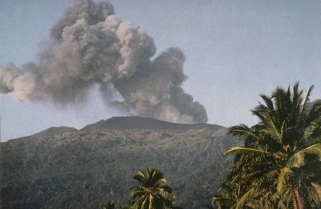
Dukono is an active volcano located in the northern part of Halmahera island. It has a broad profile and is capped by compound craters. During the major eruption in 1550, a lava flow filled in the strait between Halmahera and the north flank cone of Mount Mamuya. It was an eruption of scale 3 on VEI. Deaths were reported but the figure is unknown. Smaller eruptions occurred in 1719, 1868, and 1901. Since 1933, Dukono has been erupting continuously until the present.
Map of Dukono, North Popilo, North Tobelo, North Halmahera Regency, North Maluku, Indonesia
Eruptions in 2014 increased since early spring. Ash clouds rose up to 2,5 km height and volcanic lightning were observed and photographed on June 11. Strombolian eruptions spew lava bombs on the outer flank of the crater cone.
References
Dukono Wikipedia(Text) CC BY-SA