
Isolation 1.27 mi (2.04 km) Elevation 4,314 m Parent peak Mount Cameron | Easiest route Hike Prominence 228 m | |
 | ||
Topo map USGS 7.5' topographic mapClimax, Colorado Similar Mount Lincoln, Mount Bross, Mount Sherman, Quandary Peak, Mount Belford | ||
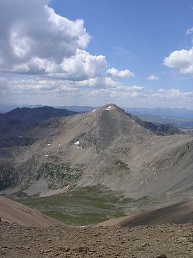
Mount Democrat is a high mountain summit in the Mosquito Range of the Rocky Mountains of North America. The 14,155-foot (4,314 m) fourteener is located 5.4 miles (8.7 km) northwest (bearing 313°) of the Town of Alma, Colorado, United States, on the Continental Divide separating San Isabel National Forest and Lake County from Pike National Forest and Park County.
Contents
Map of Mt Democrat, Colorado 80424, USA
MountainEdit
Mount Democrat is often climbed together with Mount Lincoln and nearby Mount Bross. For more information on this group of peaks, including access issues, see Mount Lincoln.
Historical namesEdit
References
Mount Democrat Wikipedia(Text) CC BY-SA