
 | ||
Elevation 633 metres (2,077 ft) AHD Parent range | ||
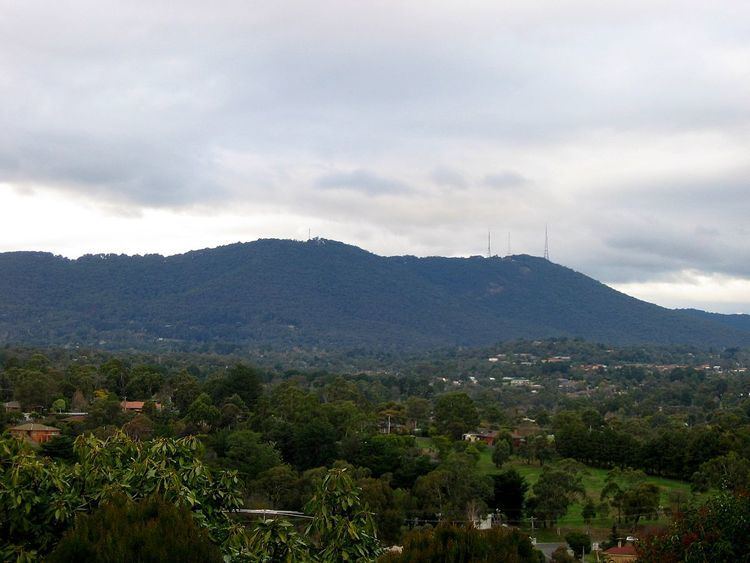
Mount Dandenong (Aboriginal Woiwurrung language: Corhanwarrabul) is a mountain that is part of the Dandenong Ranges of the Great Dividing Range, located in the Central Highlands region of Victoria, Australia. The mountain has an elevation of 633 metres (2,077 ft) and is located approximately 65 kilometres (40 mi) east of Melbourne.
Contents
- Map of Mount Dandenong VIC 3767 Australia
- Features
- Lookout
- The summit
- Tourist road
- William Ricketts Sanctuary
- References
Map of Mount Dandenong VIC 3767, Australia
Features
At Mount Dandenong are parks, forests, an arboretum, numerous lookout and many restaurants.
Lookout
Close to the summit of the mountain sits the SkyHigh Mount Dandenong restaurant, gardens and maze, re-opened in 2005.
On a clear day it is possible to see across the metropolitan area to the You Yangs and Mount Macedon, putting the Melbourne Central Business District and Port Phillip Bay into a broader geographical context.
The summit
The peak of the mountain, at 633 m above sea level, is also the site of the television and FM radio signal towers for the greater Melbourne area, which range in height from 72 m to 180 m. These towers are visible from quite a distance and distinguish Mount Dandenong from others in the Dandenong Ranges.
Tourist road
Mount Dandenong Tourist Road, the main road going through Mount Dandenong, is host to many local shops. These include cafes, restaurants and eateries, pubs, day spas, wine and fine food purveyors, a nursery and many shops selling local crafts.
William Ricketts Sanctuary
The William Ricketts Sanctuary is situated on the east face of Mount Dandenong. It has over 93 ceramic sculptures woven into the eucalyptus forest.