
- location below Devil's Thumb - elevation 0 m (0 ft) | - elevation 1,050 m (3,445 ft) Basin area 472 km² | |
 | ||
- location between Newell and Cooya Beach | ||
12 mossman riverside leisure centre mossman qld
The Mossman River is a river located in the Cape York Peninsula of Far North Queensland, Australia.
Contents
Map of Mossman River, Queensland, Australia
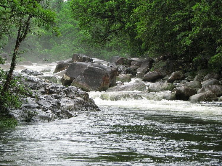
The headwaters of the river rise under Devil's Thumb on the Mount Carbine Tableland in the Great Dividing Range. The river flows through a deeply incised valley in the Mount Lewis Forest Reserve in an easterly direction and then through the Mossman Gorge, part of the Daintree National Park, and onto the coastal plain past the township of Mossman, where the river is crossed by the Captain Cook Highway. The river eventually discharges into Trinity Bay and the Coral Sea between Newell and Cooya Beach. The river descends 1,050 metres (3,440 ft) over its 24-kilometre (15 mi) course.
The river has a catchment area of 472 square kilometres (182 sq mi) of which an area of 16 square kilometres (6 sq mi) is composed of estuarine wetlands.
The river was named by the explorer George Dalrymple in 1873 after Hugh Mosman who discovered gold in Charters Towers. Dalrymple wrote "I named this river the Mossman River, after Mossman, an explorer and mining man, member of a very prominent mining family".