
- left O'Grady Creek - elevation 172 m (564 ft) | - elevation 16 m (52 ft) | |
 | ||
- right Middle Creek (Victoria) - location south of Yallourn North | ||
Love of place by the grace of the morwell river
The Morwell River is a perennial river of the West Gippsland catchment, located in the West Gippsland and South Gippsland regions of the Australian state of Victoria.
Contents
- Love of place by the grace of the morwell river
- Map of Morwell River Victoria Australia
- Morwell river falls urban travel life
- Location and features
- References
Map of Morwell River, Victoria, Australia
Morwell river falls urban travel life
Location and features
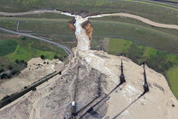
Formed by the confluence of the West Branch and East Branch of the river, the Morwell River rises in the Strzelecki Ranges, below Boolarra South. The river flows generally in a northerly direction, joined by two minor tributaries before reaching its mouth to form confluence with the Latrobe River, south of Yallourn North. The river descends 156 metres (512 ft) over its 41-kilometre (25 mi) course. The lower reaches of the river has been diverted around open-cut coal mines by channels and pipelines until it enters the Latrobe River.
On 6 June 2012, a levee bank failure resulted in the flooding of the Yallourn coal mine causing damage to its infrastructure and cutting fuel supply to the adjacent power station.