
Peak Mount Tassie Parent range Great Dividing Range | Country Australia Elevation 740 m | |
 | ||
Strzelecki ranges college creek update march 2015
The Strzelecki Ranges, also known as the Strzelecki Hills, is a low mountain range that is part of the Great Dividing Range, located in the West Gippsland region of the Australian state of Victoria. The range is situated between the Latrobe Valley to the north and Bass Strait to the south. It is named after Paweł Edmund Strzelecki, a Polish explorer, who led an expedition through this region in the 1840s.
Contents
- Strzelecki ranges college creek update march 2015
- Strzelecki ranges march 22 2015 yinnar south damp forest gets the torch
- Vegetation and topography
- History
- Recreation
- References
The ranges also form a biogeographic subregion of the South Eastern Highlands bioregion, within the Interim Biogeographic Regionalisation for Australia.
Strzelecki ranges march 22 2015 yinnar south damp forest gets the torch
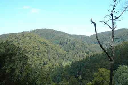
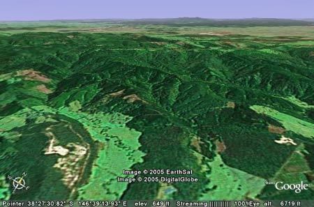
Vegetation and topography
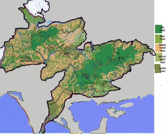
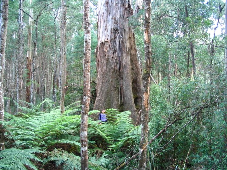
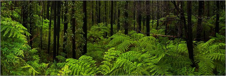
The ranges were originally covered by a mosaic of wet forest, populated by 90-metre (300 ft) tall Mountain Ash trees, and temperate rainforest. As a result of clearing for agriculture in the late 19th and early 20th centuries, and of logging activity, the native vegetation of the Strzelecki Ranges bioregion is highly depleted, with only 19% of its original extent remaining. Most of the remaining forest is in the eastern ranges. Some has been protected inside the Tarra-Bulga National Park, the Morwell National Park and the Mount Worth State Park.
The highest peak is Mount Tassie (approximately 740 metres (2,430 ft).)
History
The Strzelecki Ranges fall within the territory of the Gunai or Kurnai people of Gippsland. In the Aboriginal Boonwurrung language, the range is called Tolone. Stone axes, grinding stones and bush ovens provide evidence of their use of the tall dense forests of the ranges. The ranges were a source of lyrebird tail feathers, which were used for ornamentation and for trade.
Land selection in the western Strzelecki Ranges began in the 1870s. The steepest parts of the eastern Strzelecki Ranges were opened for selection in the 1890s. However, farming and clearing was difficult in the high, wet, densely forested areas, and many farmers abandoned their selections. Most of the remaining forest is in the eastern ranges.
Recreation
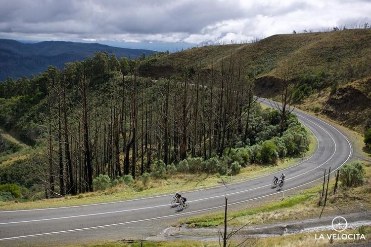
The spectacular Grand Ridge Road winds through the ranges, and provides picturesque views to the north over the Latrobe Valley and to the south towards Wilsons Promontory.