
Area 3,704 km² Population 4,908 (2013) | Founded 1908 | |
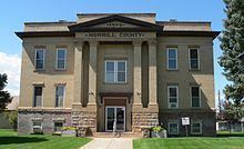 | ||
Points of interest Chimney Rock National, Bridgeport State Recreatio, Courthouse and Jail House R, Courthouse & Jail Rock | ||
Morrill County is a county located in the U.S. state of Nebraska. As of the 2010 census, the population was 5,042. Its county seat is Bridgeport.
Contents
- Map of Morrill County NE USA
- History
- Geography
- Major highways
- Adjacent counties
- National protected area
- Demographics
- References
Map of Morrill County, NE, USA
In the Nebraska license plate system, Morrill County is represented by the prefix 64 (it had the sixty-fourth-largest number of vehicles registered in the county when the license plate system was established in 1922).
History
The Battle of Mud Springs and the Battle of Rush Creek between the U.S. army and the Cheyenne, Lakota Sioux, and Arapaho Indians took place in 1865 within what would become Morrill county.
Morrill County was formed in 1908 "carved out of Cheyenne County". It was named after Charles Henry Morrill, a president of the Lincoln Land Company.
Geography
According to the U.S. Census Bureau, the county has a total area of 1,430 square miles (3,700 km2), of which 1,424 square miles (3,690 km2) is land and 6.0 square miles (16 km2) (0.4%) is water.
Major highways
Adjacent counties
National protected area
Demographics
As of the census of 2000, there were 5,440 people, 2,138 households, and 1,494 families residing in the county. The population density was 4 people per square mile (1/km²). There were 2,460 housing units at an average density of 2 per square mile (1/km²). The racial makeup of the county was 93.68% White, 0.07% Black or African American, 0.72% Native American, 0.22% Asian, 4.12% from other races, and 1.19% from two or more races. 10.09% of the population were Hispanic or Latino of any race. 40.5% were of German, 9.2% English, 7.3% Irish and 6.7% American ancestry according to Census 2000.
There were 2,138 households out of which 32.10% had children under the age of 18 living with them, 59.50% were married couples living together, 6.50% had a female householder with no husband present, and 30.10% were non-families. 26.90% of all households were made up of individuals and 13.00% had someone living alone who was 65 years of age or older. The average household size was 2.49 and the average family size was 3.03.
In the county, the population was spread out with 27.20% under the age of 18, 7.20% from 18 to 24, 24.40% from 25 to 44, 24.20% from 45 to 64, and 17.00% who were 65 years of age or older. The median age was 40 years. For every 100 females there were 97.90 males. For every 100 females age 18 and over, there were 95.60 males.
The median income for a household in the county was $30,235, and the median income for a family was $36,673. Males had a median income of $27,107 versus $19,271 for females. The per capita income for the county was $14,725. About 10.00% of families and 14.70% of the population were below the poverty line, including 20.00% of those under age 18 and 10.30% of those age 65 or over.