
 | ||
Jackie trotter emt fto ff morongo basin ambulance
The Morongo Basin is an endorheic basin and valley region located in eastern San Bernardino County, in Southern California.
Contents
- Jackie trotter emt fto ff morongo basin ambulance
- Morongo basin search rescue desert run 2013
- Geography
- Natural history
- Over 15000
- Under 15000
- Climate
- Local attractions
- Education
- References
The Morongo basin is part of the Inland Empire region, and is considered to be the easternmost portion of the Greater Los Angeles Area, the 2nd largest metropolitan region in the United States.
Morongo basin search rescue desert run 2013
Geography
The drainage basin stretches approximately from the Little San Bernardino Mountains north of Interstate 10 in the south, to the Interstate 40 area in the north. Lying within the Mojave Desert, the Morongo Basin is east of the city of San Bernardino and San Bernardino Mountains, and north of the Coachella Valley and Colorado Desert.
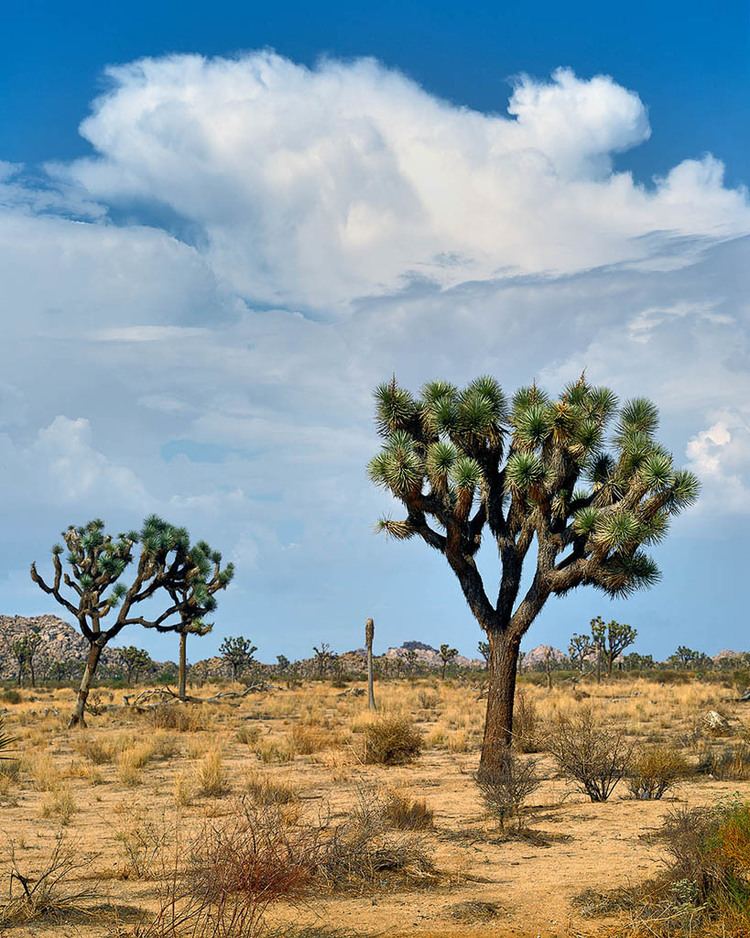
The Morongo Basin is located within the Mojave Desert and in the High Desert region of Southern California. The area's elevation can range from 1,950 feet (590 m) in Twentynine Palms, to 3,000 feet (910 m) in Yucca Valley. The higher sections of Joshua Tree National Park are within the basin.
The terrain in the area is a desert landscape of hills and alluvial fans framed by mountain ranges.
Natural history
The Mojave yucca (Yucca schidigera) (namesake of Yucca Valley) and the Joshua tree (Yucca brevifolia) (namesake of Joshua Tree city and park) are notable native plants in the region.
The basin's habitats are home to Black-tailed jackrabbits, coyotes, and the Mojave Rattlesnake (Crotalus scutulatus).
Over 15,000
Under 15,000
Climate
The climate is arid desert. Hot, dry summers; cool winters with cold mornings and occasional snow and rain showers. Snow falls in areas above 1,500 feet (460 m) in elevation.
Local attractions
Joshua Tree National Park supports most of the tourism to the Morongo Basin and Morongo Valley. The Desert Christ Park sculpture garden is located in Yucca Valley and attracts visitors from all over the nation.
Sand to Snow National Monument surrounds the Morongo Valley on all sides. Local features within it include:
Education
The Morongo Basin is home to the Morongo Unified School District, which serves all of the cities and communities in the area. Copper Mountain College is the only community college serving the Morongo Basin area, located in Joshua Tree.
The nearest four year public university is California State University, San Bernardino north of the city of San Bernardino in University Heights, California.