
Country USA County Contra Costa Elevation 499 ft (152 m) Local time Saturday 7:42 AM Area code 925 | Incorporated November 13, 1974 Time zone PST (UTC-8) Population 16,771 (2013) | |
 | ||
Weather 11°C, Wind SW at 5 km/h, 74% Humidity University | ||
Moraga (incorporating the former communities of Moraga Town, Rheem, and Rheem Valley) is a suburban incorporated town located in Contra Costa County, California, United States, in the San Francisco Bay Area. It is named in honor of Joaquin Moraga, whose grandfather was José Joaquin Moraga, second in command to Juan Bautista de Anza. As of 2010, Moraga had a total population of 16,016 people.
Contents
- Map of Moraga CA USA
- Geography
- History
- Climate
- Demographics
- 2010
- 2000
- Education
- Primary and secondary schools
- Colleges and universities
- Public libraries
- Notable people
- References
Map of Moraga, CA, USA
Geography
Moraga is located at 37°50'06" North, 122°07'47" West, at an elevation of 499 feet (152 m). It is located adjacent to the cities of Lafayette and Orinda, as well as the unincorporated community of Canyon. Other nearby cities include Walnut Creek, Oakland, San Francisco, Concord and Berkeley.
According to the United States Census Bureau, the town has a total area of 9.4 square miles (24 km2), of which, 9.4 square miles (24 km2) of it is land and 0.09% is water. Originally Moraga was abundant with pears, however, over the years more houses are being built and it is losing its pear trees. The old orchards are now reduced to but a few acres. Rimer Ranch has begun planting new fruit trees on the south edge of town. Large sections of the Lafayette-Moraga Regional Trail pass through the town.
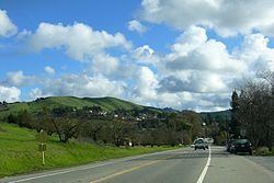
Moraga is in a valley, surrounded by rolling hills (green in the winter, brown in the summer) and grazing cows. Residents enjoy walking or biking many trails in the Lamorinda area.
Moraga is well known for its school district, which attracts many people from surrounding cities, such as Berkeley, California, Walnut Creek, and even as far away as Antioch, California.
History
The land now called Moraga was first inhabited by the Saklan Native Americans, who belonged to the Bay Miwok language group.
Joaquin Moraga was the grandson of José Joaquín Moraga, builder of the Presidio of San Francisco and founder of the pueblo that grew into the city of San Jose. Joaquin's father Gabriel Moraga was also a soldier, and an early explorer who named many of the state's rivers, including the Sacramento and San Joaquin.
Moraga is located on the 1835 Mexican Land Grant Rancho Laguna de los Palos Colorados given to Joaquin Moraga and his cousin, Juan Bernal. Part of that grant was the property today known as Moraga Ranch. The Moraga Adobe has been preserved, and is located in neighboring Orinda. Joaquin Moraga Intermediate School, a middle school in Moraga, bears his name.
In the first half of the 20th century (January 1, 1900 – December 31, 1950), the line of the Sacramento Northern Railroad ran through Moraga; much of the old right-of-way is now part of the popular Lafayette-Moraga Regional Trail.
Moraga's first post office opened in 1886, and was closed in 1887; it reopened in 1915. In 1955, Moraga built a new post office.
Saint Mary's College of California moved to Moraga in 1928.
In November 1974, Moraga was granted township, becoming the Town of Moraga. Its first park director, William Penn Mott, Jr. went on to become the 12th director of the U.S. National Park Service. He is ranked behind John Muir, and Teddy Roosevelt for his service to the national park system. In 1974, Rancho Laguna Park 8.4 acres (34,000 m2) of land located at 2101 Camino Pablo was donated to the Moraga Park Authority by Louise Glass.
Rancho Laguna II and Palos Colorados have become known as the names of two controversial proposed housing developments in Moraga – two of several projects encompassing over 1200 homes that are being considered by town officials. Other projects include Harvest Court, Via Moraga, Painted Rocks, Bollinger Valley, Indian Valley, and 500 other homes in the central area of town.
Standing next to the Moraga fire department is the hazard house. The hazard house serves as a display for elementary school tours to demonstrate all the things not to do and how to prevent a fire. The Moraga Fire Department began as a volunteer service staffed by retirees. The Moraga Fire Department is part of the Moraga Orinda Fire District.
The Moraga Safeway store opened in early 1965 and was managed by Bob Nethery. The Moraga Orchard Supply Hardware store opened in August 2005.
Climate
Moraga has a Mediterranean climate, with warm, dry summers and cool, wet winters. In the summer, morning fog is a common occurrence, but it usually burns off by the late morning or early afternoon, giving way to clear skies the rest of the day. Most of the annual rainfall comes during the winter; snow is very rare, but occasional light dustings have been seen. Over the course of a year, the town averages 26 days of 90 °F (32 °C) or higher, 40 nights of 32 °F (0 °C) or lower, and 59 days with rain. In 2014, the southwestern US was plagued by a serious drought. Moraga was badly burdened, with high fire warnings.
Demographics
As of the 2000 census, Moraga was the 79th-wealthiest place in the US with a population above 10,000. Politically, Moraga was much more conservative than the rest of the Bay Area. There were about 4,300 registered Democrats, 6,300 registered Republicans and 1,200 independent voters.
2010
The 2010 United States Census reported that Moraga had a population of 16,016. The population density was 1,696.3 people per square mile (654.9/km²). The racial makeup of Moraga was 12,201 (76.2%) White, 277 (1.7%) African American, 31 (0.2%) Native American, 2,393 (14.9%) Asian, 25 (0.2%) Pacific Islander, 281 (1.8%) from other races, and 808 (5.0%) from two or more races. Hispanic or Latino of any race were 1,123 persons (7.0%).
The Census reported that 14,293 people (89.2% of the population) lived in households, 1,545 (9.6%) lived in non-institutionalized group quarters, and 178 (1.1%) were institutionalized.
There were 5,570 households, out of which 1,945 (34.9%) had children under the age of 18 living in them, 3,685 (66.2%) were opposite-sex married couples living together, 418 (7.5%) had a female householder with no husband present, 165 (3.0%) had a male householder with no wife present. There were 121 (2.2%) unmarried opposite-sex partnerships, and 24 (0.4%) same-sex married couples or partnerships. 1,073 households (19.3%) were made up of individuals and 564 (10.1%) had someone living alone who was 65 years of age or older. The average household size was 2.57. There were 4,268 families (76.6% of all households); the average family size was 2.95.
The population was spread out with 3,474 people (21.7%) under the age of 18, 2,342 people (14.6%) aged 18 to 24, 2,193 people (13.7%) aged 25 to 44, 4,947 people (30.9%) aged 45 to 64, and 3,060 people (19.1%) who were 65 years of age or older. The median age was 45.0 years. For every 100 females there were 89.2 males. For every 100 females age 18 and over, there were 84.6 males.
There were 5,754 housing units at an average density of 609.4 per square mile (235.3/km²), of which 4,673 (83.9%) were owner-occupied, and 897 (16.1%) were occupied by renters. The homeowner vacancy rate was 0.7%; the rental vacancy rate was 4.1%. 12,073 people (75.4% of the population) lived in owner-occupied housing units and 2,220 people (13.9%) lived in rental housing units.
2000
As of the census of 2000, there are 16,290 people, 5,662 households, and 4,325 families permanently residing in the town. The population density is 1,756.9 people per square mile (678.5 people/km²). There are 5,760 housing units at an average density of 621.2 people/sq mi (239.9 people/km²). The racial makeup is 81.10% White, 1.01% Black or African American, 0.15% Native American, 12.44% Asian, 0.09% Pacific Islander, 1.45% from other races, and 3.75% from two or more races. 4.76% of the population are Hispanic or Latino of any race.
There are 5,662 households out of which 35.1% have children under age 18 living with them, 67.7% are married couples living together, 6.5% have a female householder with no husband present, and 23.6% are non-families. 19.2% of all households are made up of individuals and 8.5% have someone living alone who is 65 years of age or older. The average household size is 2.59 and the average family size is 2.99. In 2009 there were 3,570 licensed dogs in 67% of the households.
In the town the population is spread out with 22.7% under age 18, 13.9% from 18–24, 18.6% from 25–44, 29.1% from 45–64, and 15.8% who are 65 years of age or older. The median age is 42 years. For every 100 females there are 89.2 males. For every 100 females aged 18 and over, there are 84.5 males.
The median income for a household in the town is $98,080, and the median income for a family is $116,113. Males have a median income of $92,815 versus $51,296 for females. The per capita income for the town is $45,437. 2.9% of the population and 1.9% of families are below the poverty line. Out of the total population, 3.5% of those under the age of 18 and 1.0% of those 65 and older are living below the poverty line.
Education
Moraga is home to the grade schools of Los Perales Elementary, Donald L. Rheem School, Camino Pablo School, and Joaquin Moraga Intermediate School; Campolindo High School, and Saint Mary's College of California, a private college. In 2011 Moraga was named a top city to live and learn in,
Primary and secondary schools
The Moraga School District includes:
The Acalanes Union High School District includes:
The Saklan School (formerly known as Saklan Valley School and The Carden School of Moraga), a private elementary school founded in 1954, is also located in Moraga. It is a co-educational school with around 155 students from preschool to 8th grade. The school is accredited by the California Association of Independent Schools (a member of the National Association of Independent Schools), and the Western Association of Schools and Colleges. It has a maximum class size of 16.
Moraga's only public high school is Campolindo High School, although some Moraga students choose to attend Miramonte High School, located just across the town border in Orinda. Both schools are part of the Acalanes Union High School District, which encompasses Moraga, Lafayette, Orinda, and parts of Walnut Creek.
Orion Academy is a private secondary school for students with conditions such as Asperger syndrome, Attention Deficit-Hyperactivity Disorder (ADHD), and nonverbal learning disorder.
Colleges and universities
Saint Mary's College of California is located just northeast of downtown Moraga; it is a Catholic university with 3,962 undergraduate and postgraduate students in the 2007–2008 school year. The college was originally located in San Francisco and then Oakland, but moved to Moraga in 1928.
Public libraries
The Moraga Library of the Contra Costa County Library is located along Saint Marys Road in Moraga.