
Founded 1851 Population 9,121 (2013) | Area 1,810 km² | |
 | ||
Rivers Little Sioux River, Maple River, Willow Creek Points of interest Lewis and Clark State Park, Preparation Canyon State Park, Blackbird Bend Casino, Timber Ridge Winery | ||
Monona County is a county located in the U.S. state of Iowa. As of the 2010 census, the population was 9,243. The county seat is Onawa.
Contents
- Map of Monona County IA USA
- History
- Geography
- Major highways
- Adjacent counties
- 2010 census
- 2000 census
- Population ranking
- References
Map of Monona County, IA, USA
History
Monona County was formed in 1851. It was perhaps named for the Indian word meaning "beautiful valley."
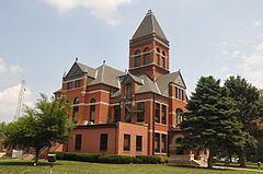
When Ashton (originally called Bloomfield ) was named the county seat in the fall of 1854, a log house served as the first courthouse. Ashton remained the county seat for only four years. On April 5, 1858, Onawa was voted the permanent seat of the county.
The first Monona County Courthouse was completed in 1858.
Geography
According to the U.S. Census Bureau, the county has a total area of 699 square miles (1,810 km2), of which 694 square miles (1,800 km2) is land and 4.9 square miles (13 km2) (0.7%) is water.
Major highways
Adjacent counties
2010 census
The 2010 census recorded a population of 9,243 in the county, with a population density of 13.3354/sq mi (5.14881/km2). There were 4,697 housing units, of which 4,050 were occupied.
2000 census
As of the census of 2000, there were 10,020 people, 4,211 households, and 2,737 families residing in the county. The population density was 14 people per square mile (6/km²). There were 4,660 housing units at an average density of 7 per square mile (3/km²). The racial makeup of the county was 98.34% White, 0.08% Black or African American, 0.76% Native American, 0.12% Asian, 0.04% Pacific Islander, 0.08% from other races, and 0.58% from two or more races. 0.70% of the population were Hispanic or Latino of any race.
There were 4,211 households out of which 26.70% had children under the age of 18 living with them, 54.50% were married couples living together, 7.10% had a female householder with no husband present, and 35.00% were non-families. 31.00% of all households were made up of individuals and 17.50% had someone living alone who was 65 years of age or older. The average household size was 2.31 and the average family size was 2.88.
In the county, the population was spread out with 23.20% under the age of 18, 6.20% from 18 to 24, 23.30% from 25 to 44, 23.30% from 45 to 64, and 23.90% who were 65 years of age or older. The median age was 43 years. For every 100 females there were 94.20 males. For every 100 females age 18 and over, there were 90.50 males.
The median income for a household in the county was $33,235, and the median income for a family was $41,172. Males had a median income of $27,349 versus $19,607 for females. The per capita income for the county was $17,477. About 6.60% of families and 9.40% of the population were below the poverty line, including 8.90% of those under age 18 and 9.50% of those age 65 or over.
Population ranking
The population ranking of the following table is based on the 2010 census of Monona County.
† county seat