
Founded 1800 Population 101,546 (2013) | Seat Gettysburg Congressional district 4th Website www.adamscounty.us Area 1,352 km² Unemployment rate 3.8% (Apr 2015) | |
 | ||
Points of interest Gettysburg National Military P, Gettysburg Battlefield, Eisenhower National Historic S, Gettysburg Museum and Visito, Sachs Covered Bridge Colleges and Universities Gettysburg College, Lutheran Theological Seminary, Harrisburg Area Communi | ||
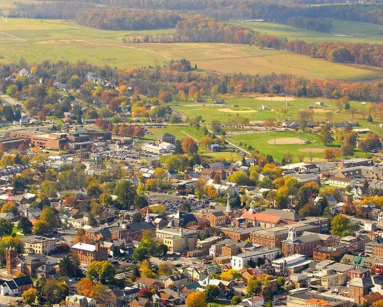
Adams County is a county in the U.S. state of Pennsylvania. As of the 2010 census, the population was 101,407. Its county seat is Gettysburg. The county was created on January 22, 1800, from part of York County and named in honor of the second President of the United States, John Adams. On 1–3 July 1863, Gettysburg and its vicinity was the site of the pivotal battle of the American Civil War, and as a result is a center for Civil War tourism.
Contents
- Map of Adams County PA USA
- Geography
- Adjacent counties
- National protected areas
- Law and government
- United States Senate
- Demographics
- Metropolitan and Combined Statistical Area
- Colleges and universities
- Community junior and technical colleges
- Public school districts
- Public charter schools
- Private schools
- Intermediate Unit
- Libraries
- Air
- Bus
- Major Highways
- Recreation
- Communities
- Census designated places
- Population ranking
- Notable people
- References
Map of Adams County, PA, USA
Adams County comprises the Gettysburg, PA Metropolitan Statistical Area, which is also included in the Harrisburg-York-Lebanon, PA Combined Statistical Area.
Geography
According to the U.S. Census Bureau, the county has a total area of 522 square miles (1,350 km2), of which 519 square miles (1,340 km2) is land and 3.1 square miles (8.0 km2) (0.6%) is water. The Borough of Gettysburg is located at the center of Adams County. This county seat community is surrounded on three sides by the Gettysburg National Military Park (GNMP). The Eisenhower National Historic Site adjoins GNMP on its southwest edge. Most of Adams County's rural landscapes and its mid-19th century roadway pattern remain intact today. Thirteen historic roadways converge at or near Gettysburg Borough. Two circular rings of towns surround Gettysburg; the first ring is typically found at a distance of about 7 miles (11 km) from Gettysburg. The second ring is found at a distance of 12 to 15 miles (24 km) from the County Seat. This "spokes and wheel" pattern represents one of the few examples of Central Place Theory in the Eastern United States.
The county is in the watershed of the Chesapeake Bay and is drained by the Susquehanna River and Potomac River.
Adjacent counties
National protected areas
Law and government
Presidential politics
Adams County is a Republican County, in 2016 Donald Trump carried the county with 66.3% of the vote to Hillary Clinton's 29.9%.
United States Senate
Demographics
As of the census of 2010, there were 101,407 people, 33,652 households, and 24,767 families residing in the county. The population density was 194 people per square mile (75/km²). There were 35,831 housing units at an average density of 69 per square mile (27/km²). The racial makeup of the county was 95.39% White, 1.21% Black or African American, 0.20% Native American, 0.49% Asian, 0.02% Pacific Islander, 1.71% from other races, and 0.97% from two or more races. 3.64% of the population were Hispanic or Latino of any race. 42.7% were of German, 14.1% American, 8.5% Irish and 7.1% English ancestry according to Census 2000. 95.0% spoke English and 3.6% Spanish as their first language.
There were 33,652 households out of which 33.70% had children under the age of 18 living with them, 61.10% were married couples living together, 8.50% had a female householder with no husband present, and 26.40% were non-families. 21.30% of all households were made up of individuals and 9.20% had someone living alone who was 65 years of age or older. The average household size was 2.61 and the average family size was 3.02.
In the county, the population was spread out with 24.90% under the age of 18, 9.20% from 18 to 24, 28.90% from 25 to 44, 23.00% from 45 to 64, and 13.90% who were 65 years of age or older. The median age was 37 years. For every 100 females there were 96.30 males. For every 100 females age 18 and over, there were 93.80 males. Adams County is one of two counties in Pennsylvania where Latter-Day Saints make up 1% of the population.
Per the Pennsylvania Department of Health, Adams County's live birth rate was 1,132 births in 1990. The County's live birth rate in 2000 was 1,048 births, while in 2011 it had declined to 1,039 babies. Over the past 50 years (1960 to 2010), rural Pennsylvania saw a steady decline in both the number and proportion of residents under 18 years old. In 1960, 1.06 million rural residents, or 35 percent of the rural population, were children.
Adams County had a 29 babies born to teens (age15-19) in 2011. In 2014, the number of teen births in Adams County was 27.
According to research by The Center for Rural Pennsylvania, which is a legislative Agency of the Pennsylvania General Assembly, the poverty rate for Adams County was 10.8% in 2014. The statewide poverty rate was 13.6% in 2014. The 2012 childhood poverty rate by school district was: Bermudian Springs School District - 32.4% living at 185% or below than the Federal Poverty Level, Conewago Valley School District - 37.3%, Fairfield Area School District - 19.5%, Gettysburg Area School District - 42.3%, Littlestown Area School District - 32.1%, and Upper Adams School District - 45.5%.
Metropolitan and Combined Statistical Area
The United States Office of Management and Budget has designated Adams County as the Gettysburg, PA Metropolitan Statistical Area (MSA). As of the 2010 U.S. Census the metropolitan area ranked 19th most populous in the State of Pennsylvania and the 349th most populous in the United States with a population of 101,407. Adams County is also a part of the larger Harrisburg-York-Lebanon, PA Combined Statistical Area (CSA), which combines the populations of Adams County as well as Cumberland, Dauphin, Lebanon, Perry and York Counties in Pennsylvania. The Combined Statistical Area ranked 5th in the State of Pennsylvania and 43rd most populous in the United States with a population of 1,219,422.
Colleges and universities
Community, junior and technical colleges
Public school districts
The 496 school districts of Pennsylvania, that operate high schools, were ranked for student academic achievement as demonstrated by three years of math, reading, writing and science PSSA results.
Public charter schools
County residents may also apply to attend any of the Commonwealth's 14 public, cyber charter schools (in 2015) at no additional cost to the parents.
Private schools
As reported by Pennsylvania Department of Education April 2015
Intermediate Unit
Lincoln Intermediate Unit (IU#12) region includes: Adams County, Franklin County and York County. The agency offers school districts, home schooled students and private schools many services including: Special education services, combined purchasing, and instructional technology services. It runs Summer Academy which offers both art and academic strands designed to meet the individual needs of gifted, talented and high achieving students. Additional services include: Curriculum Mapping, Professional Development for school employees, Adult Education, Nonpublic School Services, Business Services, Migrant & ESL (English as a Second Language), Instructional Services, Special Education, Management Services, and Technology Services. It also provides a GED program to adults who want to earn a high school diploma and literacy programs. The Lincoln Intermediate Unit is governed by a 13-member Board of Directors, each a member of a local school board from the 25 school districts. Board members are elected by school directors of all 25 school districts for three-year terms that begin July 1. There are 29 intermediate units in Pennsylvania. They are funded by school districts, state and federal program specific funding and grants. IUs do not have the power to tax.
Libraries
Air
There are currently no scheduled commercial flights into Adams County, and travel is limited to general aviation airfields. The nearest airports with regular commercial service are in Hagerstown, Maryland (Hagerstown Regional Airport), Harrisburg, Pennsylvania (Harrisburg International Airport), and Lancaster, Pennsylvania (Lancaster Airport).
Bus
Public bus service in Adams County is available through the Adams County Transit Authority.
Major Highways
US 15 Bus.
Recreation
There is one Pennsylvania state park in Adams County.
Communities
Under Pennsylvania law, there are four types of incorporated municipalities: cities, boroughs, townships, and, in at most two cases, towns. The following boroughs and townships are located in Adams County:
Census-designated places
Census-designated places are geographical areas designated by the U.S. Census Bureau for the purposes of compiling demographic data, but are not actual jurisdictions under Pennsylvania law. Other unincorporated communities, such as villages, may be listed here as well.
Population ranking
The population ranking of the following table is based on the 2010 census of Adams County.
† county seat