
Max length 5 km | Width 3 km (1.9 mi) Population 146334 (1999) | |
 | ||
Similar Fort Jesus, Diani Beach, Shimba Hills National, Haller Park, Nyali Bridge | ||
Mombasa vacation
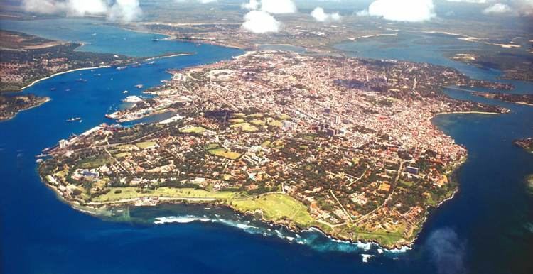
Mombasa Island is a 5 by 3 km (3.1 by 1.9 mi) coral outcrop located on Kenya's coast on the Indian Ocean, which is connected to the mainland by a causeway. Part of the city of Mombasa is located on the island, including the Old Town.
Contents
Map of Mombasa Island, Mombasa, Kenya
History
The old town of Mombasa is located at the eastern, seaward end of the island. Kilindini and Port Reitz, the modern deepwater harbour and port separates the island from the Kenyan mainland to the south. The old harbour, which is named Port Tudor and guarded by Fort Jesus, and Tudor Creek separate the island from the northern mainland. Modern residential sprawl and industrial areas now occupy the rest of the island.
Mombasa is linked to the mainland by the Makupa Causeway to the northwest, by the Nyali Bridge to the east and by the Likoni Ferry to the south. A road and rail bridge also serve the mainland container port near Port Reitz.
Port Tudor and Tudor Creek were named by Owen Tudor the Royal Navy captain who first surveyed the area.
Geography
Mombasa Island in one of the four divisions of Mombasa County. The division has a population of 146,334 (1999 census). It is divided into six subdivisions: