
Type Road | Length 27 km (17 mi) | |
 | ||
Moggill road cycle bridge
Moggill Road is a major road in Brisbane, Queensland, Australia. It commences at High Street at Toowong and terminates at the Moggill Ferry in Moggill. It is part of State Route 33. The road carried an average of 39,305 vehicles per day between July and December 2014.
Contents
Map of Moggill Rd, Queensland, Australia
It passes through the Brisbane suburbs of Toowong, Taringa, Indooroopilly, Chapel Hill, Kenmore, Pullenvale, Pinjarra Hills, Bellbowrie and Moggill.
It stretches 27 km (17 mi). $14 million worth of road works started in 2010, $32 million in 2009, following a further $27 million completed in 2008.
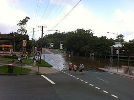
Flooding
During the 2010–2011 Queensland floods, Moggill Road flooded in a number of places, including:
The flooding causes the suburbs of Bellbowrie, Moggill and Karana Downs to be cut off, leading to shortages of food and medical supplies.