
Population 8,483 (2011 census) Area 5.2 km² | Postcode(s) 4069 Postal code 4069 | |
 | ||
LGA(s) City of Brisbane(Pullenvale Ward) | ||
Kenmore is a suburb of the City of Brisbane, Queensland, Australia. It is on the Brisbane River 10 kilometres (6.2 mi) south-west of the Brisbane CBD. Kenmore is a leafy suburb with a high number of professional residents and families. It is dominated by detached housing, but townhouses and units are increasing within the suburb. Kenmore has benefited greatly from the Centenary Highway which gives it direct access to the city via Milton Road, Coronation Drive, or since 2015 the Legacy Way (toll road).
Contents
- Map of Kenmore QLD 4069 Australia
- Demographics
- History
- Attractions
- Sports
- Community groups
- Transport
- References
Map of Kenmore QLD 4069, Australia
There are a number of schools in the suburb, including Kenmore State School, Kenmore South State School, Kenmore State High School and private Christian schools. There are a large number of restaurants as well as two large retail centres, Kenmore Village and Kenmore Plaza, located on Moggill Road.
As one of the suburbs developed during the 1950s and 1960s, Kenmore is currently experiencing a surge of renovation and modernisation. Kenmore is characterised by rolling hills and greenery.
Demographics
In the 2011 census, Kenmore recorded a population of 8,483 people, 51.3% female and 48.7% male.
The median age of the Kenmore population was 39 years of age, 2 years above the Australian median.
66% of people living in Kenmore were born in Australia, compared to the national average of 69.8%; the next most common countries of birth were England 6%, South Africa 3.2%, New Zealand 2.9%, India 1.5%, United States of America 1.1%.
82.9% of people spoke only English at home; the next most common languages were 1.6% Mandarin, 0.9% Korean, 0.9% Japanese, 0.8% Cantonese, 0.7% Spanish.
History
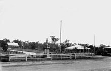
The residents of the Shire of Moggill commissioned a war memorial which was unveiled on 3 July 1920 by General Spencer Browne and Edward Macartney, the Member of the Queensland Legislative Assembly for Toowong.
Kenmore's history has been compiled by local historian, Lesley Jenkins, as part of the BRISbites community history project. A lengthier local online history has been compiled by David Horton and Kerry Raymond.
Kenmore was one of many Brisbane suburbs partially affected by the 2010–2011 Queensland floods.
Attractions
Kenmore Village Shopping Centre is a central shopping centre located near the Moggill Road and Brookfield Road intersection. The shopping centre also has offices. Kenmore Plaza is another large shopping centre in the area. There are restaurants in Kenmore, including cafés, take-aways and pubs. The Indooroopilly Shopping Centre, a large mall with over 250 retail outlets, is about two km from Kenmore.
The Brisbane City Council has opened a new council library at the Kenmore Village Shopping Centre on Moggill Road. Kenmore has a number of churches, including Our Lady of the Rosary, Riverlife Baptist Church (formerly Kenmore Baptist Church), Kenmore Community Church (currently located in Bellbowrie), Kenmore Anglican Church, Fuel Christian Church, Kenmore Presbyterian Church and Kenmore Uniting Church.
Sports
Kenmore has numerous parks and playing fields. It has easy access to outdoors activities in surrounding suburbs, including walking tracks and roads to Mt Coot-tha lookout, Brisbane Botanic Gardens and the planetarium; boating ramps into the Brisbane River and horse riding facilities in Fig Tree Pocket and Brookfield.
It has a variety of sporting venues that are available for use. The largest and easiest to access is Akuna Oval, which has areas for soccer, AFL and rugby, as well as extensive walking tracks throughout the area. Other venues that can be rented are the Kenmore Primary School tennis courts and some facilities at Kenmore South Primary School. Community classes are often held at various areas around Kenmore during term-time and these classes range from yoga to fencing to pilates. There is also a women-only gym, Curves International, on Brookfield Road and a Jett's Gym, on Marshall Lane.
Active sporting groups include Kenmore Australian Football Club, Gem Road Park Soccer Association, Kenmore Lions Football Club and Kenmore Century Bears Rugby Union. In October 2012, the Kenmore Football Club merged with the University of Queensland Football Club.
Community groups
Kenmore is dissected by Moggill Creek. The Moggill Creek Catchment Group organises working bees to rid the creek area of rubbish and introduced plant species, which are not suited to the area. The Rotary Club of Kenmore is non-political, non-denominational and open to all cultures, races and creeds.
Transport
Kenmore is well connected to the city and the University of Queensland by road and bus.
The main road through Kenmore is Moggill Road. The retail centre of Kenmore is clustered around the roundabout where Brookfield and Moggill Roads intersect. Another transport hub is at the Kenmore Tavern complex, on the corner of Marshall Lane and Moggill Road.
A motorway extension known as the Kenmore Bypass has been proposed, to alleviate congestion along Moggill Road during peak commuting hours, but has met widespread opposition from local residents because of the inevitable resumption of residential properties, loss of amenity and disruption associated with building a major new road through an established residential area.
There is no rail station in Kenmore. Indooroopilly is the closest station. In the 1890s the Queensland Parliament approved the construction of a rail line from Indooroopilly to Brookfield, running through the southern side of Kenmore following the valley of Cubberla Creek and thence roughly parallel to the present alignment of Kersley Road. However the line was never constructed.