
Local time Wednesday 4:38 AM | ||
 | ||
Weather 26°C, Wind S at 6 km/h, 91% Humidity | ||
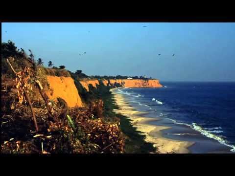
Moanda or Muanda is a town and territory lying on the Atlantic Ocean coast of the Democratic Republic of Congo at the mouth of the Congo River. It is situated in Kongo Central Province, and has a population of 50,000. The town has an airport, IATA Code FZAG (05°55′51″S 012°21′06″E), is known for its beaches, and has a few limited tourist facilities, but tourism is incidental to the main economic activities of the town.
Contents
Map of Muanda, Democratic Republic of the Congo
The town of Muanda is 8 kilometres (5.0 mi) north-west of the small port of Banana in the mouth of the Congo, and 6.5 kilometres (4.0 mi) southeast of Point Kipundji. The Moanda Oil Terminal, consisting of various platforms, pipelines and a permanent tanker, lies 10 miles southwest of Point Kipundji. Some 100 km upstream from Muanda, on the north bank of the Congo River, lies the city of Boma, DR Congo's second-largest port. The great width and depth of the Congo River allow seagoing vessels to reach Boma and the largest port, Matadi, despite their distance from the coast.
Climate
Köppen-Geiger climate classification system classifies its climate as tropical wet and dry (Aw).