
Surface area 750 acres (300 ha) Surface elevation 56 m Mean depth 2.44 m | Basin countries United States Average depth 8 ft (2.4 m) Area 3.035 km² | |
 | ||
Dry camping at mittry lake in yuma arizona on blm land
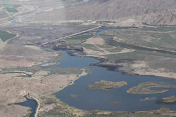
Mittry Lake is located in the Mittry Lake Wildlife Area, just north of Yuma, Arizona, on the Lower Colorado River. It is located in between the upstream Imperial Dam and the downstream Laguna Dam. Mittry Lake comprises about 750 acres (300 ha), with much of the shoreline covered with cattails and bullrush. The lake has undergone rehabilitation work including marsh dredging, revegetation and fish habitat improvement, making it a great location for small game hunting and sport fishing. It is public land managed by both the Arizona Game and Fish Department and Bureau of Land Management, and available to the public for recreational purposes.
Contents
- Dry camping at mittry lake in yuma arizona on blm land
- Map of Mittry Lake Arizona 85365 USA
- Mittry lake near yuma az fishing for bass
- La Laguna
- Fish species
- References
Map of Mittry Lake, Arizona 85365, USA
Mittry lake near yuma az fishing for bass
La Laguna
La Laguna was a mining town that was in existence for a short time from 1860 to 1862. The town had a few merchants and a ferry across the Colorado River that served placer miners in the vicinity. When the La Paz gold rush began, La Laguna was abandoned. Its former site now lies beneath Mittry Lake.