
Founded November 9, 1864 Congressional districts 3rd, 4th Website www.yumacountyaz.gov Population 201,201 (2013) | Area 14,294 km² Unemployment rate 22.2% (Apr 2015) | |
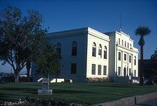 | ||
Points of interest Yuma Territorial Prison, Yuma Lettuce Days, West Wetlands Park, Cocopah Casino, Gateway Park | ||
Yuma County is a county in the southwestern corner of the U.S. state of Arizona. As of the 2010 census, its population was 195,751. The county seat is Yuma.
Contents
- Map of Yuma County AZ USA
- History
- Economy
- Government
- Geography
- Major highways
- National protected areas
- 2000 census
- 2010 census
- Cities
- Town
- Other unincorporated communities
- Indian reservations
- County population ranking
- References
Map of Yuma County, AZ, USA
Yuma County comprises the Yuma, AZ Metropolitan Statistical Area.
The county borders the Colorado River to the southwest, with three other states across the river: California of the United States and the Mexican state of Baja California to the west, and Sonora, Mexico, 60 miles to the south.
History
Long settled by Native Americans of indigenous cultures for thousands of years, this area was controlled by the Spanish Empire in the colonial era. In the 19th century, it was part of independent Mexico before the Mexican–American War and Gadsden Purchase.
Yuma County was one of four original Arizona counties created by the 1st Arizona Territorial Legislature. The county territory was defined as being west of longitude 113° 20' and south of the Bill Williams River. Its original boundaries remained the same until 1982, when La Paz County was created from its northern half.
The original county seat was the city of La Paz; in 1871 it was moved to Arizona City, later renamed as Yuma in 1873.
Economy
Because of Yuma County's location along the U.S.-Mexico border, large numbers of illegal aliens entering the United States illegally pass through Yuma County. From October to July 2005, some 124,400 illegal foreign nationals were apprehended in the area, a 46% increase over the previous year. In 2015, however, only 6,000 people were apprehended, as the border was fortified and augmented. The number of illegal immigrants also declined with slumps in the US economy.
Agriculture is a $3 billion business annually, employing tens of thousands of workers but at minimum wages. During the agricultural season from November to March, some 40,000 Mexican workers cross the border daily to work in United States fields.
Leaders in the county are aware that their economy is tied to that of Mexican states on the other side of the border; both have to be considered. "There are automotive plants in Ciudad Juárez, across from El Paso; aerospace plants in Mexicali, southwest of Yuma; and medical devices’ manufacturers in Tijuana, near San Diego. On the American side, there is a mix of retail stores, warehouses and trucking companies..."
Government
The Board of Supervisors is the governing body of the county and a number of special districts. The Board adopts ordinances, establishes programs, levies taxes, appropriates funds, appoints certain officials, and zones property and regulates development in the unincorporated area. In addition, members of the Board represent the County on numerous intergovernmental agencies.
In 2016 county voters elected more Democrats to the Board than Republicans, for the first time since 2004. In 2016 the population of the county was 62% Latino, and many of them are Democrats. But Donald Trump won the county by one percentage point in the presidential election, appealing to people about jobs.
Geography
According to the U.S. Census Bureau, the county has a total area of 5,519 square miles (14,290 km2), of which 5,514 square miles (14,280 km2) is land and 5.1 square miles (13 km2) (0.09%) is water. The lowest point in the state of Arizona is located on the Colorado River in San Luis in Yuma County, where it flows out of Arizona and into Sonora in Mexico.
Yuma County is in the west, and northwestern regions of the north-south Sonoran Desert that extends through Sonora state Mexico to the border of northern Sinaloa state. West of the county across the Colorado River in southeast California is the Colorado Desert, (a northwestern subregion of the Sonoran Desert). North of the county, with La Paz County the regions merge into the southeastern Mojave Desert. Southwest of Yuma County, is the entirety of Northwest Mexico, at the north shoreline of the Gulf of California, and the outlet of the Colorado River into the Colorado River Delta region, now altered with lack of freshwater inputs. Notable mountains in Yuma County include the Gila Mountains and the Tule Mountains.
Major highways
National protected areas
2000 census
As of the 2000 census, there were 160,026 people, 53,848 households, and 41,678 families residing in the county. The population density was 29 people per square mile (11/km²). There were 74,140 housing units at an average density of 13 per square mile (5/km²). The racial makeup of the county was 68.3% White, 2.2% Black or African American, 1.6% Native American, 0.9% Asian, 0.1% Pacific Islander, 23.6% from other races, and 3.2% from two or more races. 50.5% of the population were Hispanic or Latino of any race. 43.7% reported speaking Spanish at home [1].
There were 53,848 households out of which 36.9% had children under the age of 18 living with them, 62.3% were married couples living together, 11.2% had a female householder with no husband present, and 22.6% were non-families. 18.5% of all households were made up of individuals and 8.9% had someone living alone who was 65 years of age or older. The average household size was 2.86 and the average family size was 3.27.
In the county, the population was spread out with 28.9% under the age of 18, 10.0% from 18 to 24, 25.6% from 25 to 44, 18.9% from 45 to 64, and 16.5% who were 65 years of age or older. The median age was 34 years. For every 100 females there were 102.00 males. For every 100 females age 18 and over, there were 101.10 males.
The median income for a household in the county was $32,182, and the median income for a family was $34,659. Males had a median income of $27,390 versus $22,276 for females. The per capita income for the county was $14,802. About 15.5% of families and 19.2% of the population were below the poverty line, including 27.9% of those under age 18 and 8.7% of those age 65 or over.
2010 census
As of the 2010 United States Census, there were 195,751 people, 64,767 households, and 48,976 families residing in the county. The population density was 35.5 inhabitants per square mile (13.7/km2). There were 87,850 housing units at an average density of 15.9 per square mile (6.1/km2). The racial makeup of the county was 70.4% white, 2.0% black or African American, 1.6% American Indian, 1.2% Asian, 0.2% Pacific islander, 20.8% from other races, and 3.8% from two or more races. Those of Hispanic or Latino origin made up 59.7% of the population. In terms of ancestry, 10.6% were German, 7.4% were English, 6.9% were Irish, and 3.2% were American.
Of the 64,767 households, 41.1% had children under the age of 18 living with them, 56.8% were married couples living together, 13.8% had a female householder with no husband present, 24.4% were non-families, and 19.6% of all households were made up of individuals. The average household size was 2.93 and the average family size was 3.39. The median age was 33.8 years.
The median income for a household in the county was $40,340 and the median income for a family was $42,718. Males had a median income of $36,345 versus $27,262 for females. The per capita income for the county was $18,418. About 17.6% of families and 20.9% of the population were below the poverty line, including 30.7% of those under age 18 and 12.7% of those age 65 or over.
Cities
Town
Other unincorporated communities
Indian reservations
County population ranking
The population ranking of the following table is based on the 2010 census of Yuma County.
† county seat