
Area 243 km² Local time Monday 6:32 AM | Postal code 516-0194 Population 14,217 (28 Feb 2015) | |
 | ||
Precipitation/yr 2,182.5mm (85.93 inches) Weather 4°C, Wind NW at 3 km/h, 93% Humidity Points of interest Nankaitenbo Park, Kasaragi Observatory, Ryusenzan | ||
Minamiise mie ken
Minamiise (南伊勢町, Minamiise-chō) is a town located in Watarai District, Mie Prefecture, Japan. Minamiise was formed in 2005 with the merger of the towns Nansei and Nantō.
Contents
- Minamiise mie ken
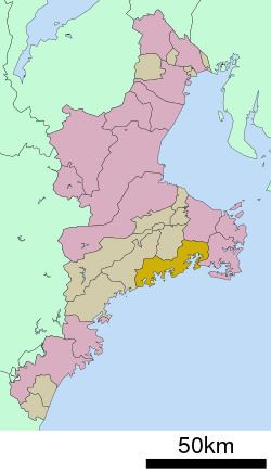
- Map of Minamiise Watarai District Mie Prefecture Japan
- Geography
- Adjacent municipalities
- History
- Economy
- Railway
- Highway
- References
Map of Minamiise, Watarai District, Mie Prefecture, Japan
Geography
Minamiise occupies a ria coastal region with numerous deeply indented bays located in the eastern part of the Kii Peninsula in central Mie Prefecture, along the Kumano Sea. Parts of Minamiise are inside Ise-Shima National Park.
Adjacent municipalities
History
Minamiise was once part of the old Shima Province, and became a part of Ise Province during the Sengoku period. The current town of Minamiise was formed on October 1, 2005 though the merger of the towns of Nansei and Nantō.
Economy
The economy of Minamiise is dominated by commercial fishing. Most of the business center around main town centers of Nansei and Nanto.
Railway
There are no trains in Minamiise.