
- elevation 4,403 ft (1,342 m) - elevation 2,024 ft (617 m) Length 1,173 km Discharge 17.5 m³/s | - average 618 cu ft/s (17 m/s) Basin area 61,642 km² | |
 | ||
- max 45,300 cu ft/s (1,283 m/s) Countries Canada, United States of America | ||
The Milk River is a tributary of the Missouri River, 729 mi (1,173 km) long, in the United States state of Montana and the Canadian province of Alberta. Rising in the Rocky Mountains, the river drains a sparsely populated, semi-arid watershed of 23,800 sq mi (62,000 km2), ending just east of Fort Peck, Montana.
Contents
Map of Milk River
GeographyEdit
It is formed in Glacier County in northwestern Montana, 21 miles (34 km) north of Browning, Montana, by the confluence of its South and Middle forks. The 30-mile (48 km) long South Fork and 20-mile (32 km) long Middle Fork both rise in the Rocky Mountains just east of Glacier National Park, in the Blackfeet Indian Reservation. Much of the water in the North Fork is diverted from the St. Mary River through a canal and inverted siphon.
The main stream flows east-northeast into southern Alberta, where it is joined by the North Fork of the Milk River, from there It flows past the town of Milk River and Writing-on-Stone Provincial Park, then turns southeast into Montana, running east along the north side of the Sweetgrass Hills, turning south, passing through the Fresno Dam, then east past Havre and along the north side of the Fort Belknap Indian Reservation. Near Malta, it turns north, then southeast, flowing past Glasgow and joining the Missouri in Valley County, Montana, 5 miles (8 km) downstream from Fort Peck Dam.
HistoryEdit
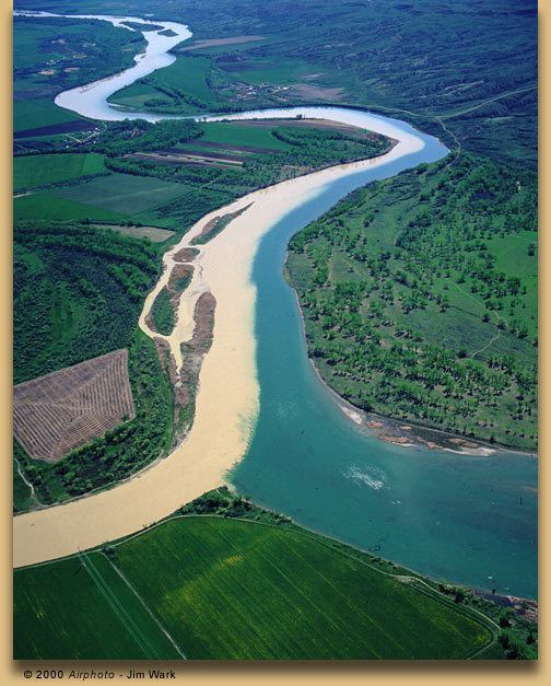
The Milk River was given its name by Captain Meriwether Lewis, of the Lewis and Clark Expedition, who described the river in his journal:
"the water of this river possesses a peculiar whiteness, being about the colour of a cup of tea with the admixture of a tablespoonfull of milk. from the colour of its water we called it Milk river."This appearance results from clays and silts suspended in its waters. These fine-grained sediments result from the erosion of soft clay-rich rocks along the Milk River basin in southern Alberta, such as the Foremost, Oldman and Dinosaur Park formations.
At the time of Lewis's exploration, the Milk River drainage was legally part of the United States as a component of the Louisiana Purchase. However, in 1818 U.S. negotiators swapped a portion of the Milk River watershed that lay north of 49° north latitude, receiving in exchange a parcel of Red River of the North drainage that had previously been part of British North America.
In 1908, the waters of the Milk River were the subject of a United States Supreme Court case clarifying the water rights of American Indian reservations. The case is known as Winters v. United States.