
Area code(s) 406 Elevation 1,334 m Population 1,035 (2013) | Time zone Mountain (MST) (UTC-7) FIPS code 30-10375 Zip code 59417 Local time Saturday 2:00 PM | |
 | ||
Weather 4°C, Wind SW at 31 km/h, 50% Humidity | ||
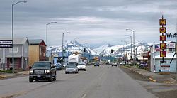
Browning is a town in Glacier County, Montana, lying within the confines of the Blackfeet Indian Reservation. The population was 1,016 at the 2010 United States Census.
Contents
- Map of Browning MT 59417 USA
- Geography
- Climate
- 2010 census
- 2000 census
- Media
- Transportation
- Education
- Notable people
- Popular culture
- References
Map of Browning, MT 59417, USA
Geography
Browning is located at 48°33′25″N 113°0′52″W (48.556917, -113.014571).
According to the United States Census Bureau, the town has a total area of 0.27 square miles (0.70 km2), all of it land.
Climate
From January 23, 1916, to January 24, 1916, the temperature fell 100 °F (56 °C) from 44 °F (7 °C) to -56 °F (-49 °C). This is the United States' and also the world record for the greatest temperature drop in 24 hours. Temperatures above 90 °F (32 °C) occur an average of 2 days annually, temperatures below 32 °F (0 °C) occur an average of 196 days annually, and those below 0 °F (−18 °C) occur an average of 32 days annually.
2010 census
As of the census of 2010, there were 1,016 people, 360 households, and 243 families residing in the town. The population density was 3,763.0 inhabitants per square mile (1,452.9/km2). There were 394 housing units at an average density of 1,459.3 per square mile (563.4/km2). The racial makeup of the town was 5.5% White, 92.7% Native American, and 1.8% from two or more races. Hispanic or Latino of any race were 3.7% of the population.
There were 360 households of which 45.3% had children under the age of 18 living with them, 28.6% were married couples living together, 28.6% had a female householder with no husband present, 10.3% had a male householder with no wife present, and 32.5% were non-families. 27.2% of all households were made up of individuals and 8% had someone living alone who was 65 years of age or older. The average household size was 2.82 and the average family size was 3.43.
The median age in the town was 29.8 years. 33.1% of residents were under the age of 18; 9.6% were between the ages of 18 and 24; 23.6% were from 25 to 44; 23% were from 45 to 64; and 10.7% were 65 years of age or older. The gender makeup of the town was 46.1% male and 53.9% female.
2000 census
As of the census of 2000, there were 1,065 people, 360 households, and 254 families residing in the town. The population density was 3,911.2 people per square mile (1,523.0/km²). There were 409 housing units at an average density of 1,502.0 per square mile (584.9/km²). The racial makeup of the town was 6.57% White, 90.52% Native American, 0.09% from other races, African American, 0.09% and 2.72% from two or more races. Hispanic or Latino of any race were 1.88% of the population.
There were 360 households out of which 39.2% had children under the age of 18 living with them, 36.7% were married couples living together, 25.3% had a female householder with no husband present, and 29.2% were non-families. 27.2% of all households were made up of individuals and 8.9% had someone living alone who was 65 years of age or older. The average household size was 2.81 and the average family size was 3.40.
In the town, the population was spread out with 31.5% under the age of 18, 10.3% from 18 to 24, 28.1% from 25 to 44, 18.1% from 45 to 64, and 12.0% who were 65 years of age or older. The median age was 31 years. For every 100 females there were 83.0 males. For every 100 females age 18 and over, there were 77.2 males.
The median income for a household in the town was $23,879, and the median income for a family was $25,000. Males had a median income of $24,375 versus $20,972 for females. The per capita income for the town was $8,955. About 28.3% of families and 29.2% of the population were below the poverty line, including 33.4% of those under age 18 and 23.6% of those age 65 or over.
Media
Browning is home to low-power radio station KBWG-LP, broadcasting at 107.5 FM.
Transportation
Education
Browning is home to Blackfeet Community College.
Notable people
Popular culture
Browning is the setting for the TV-series The X-Files episode "Shapes".