
Country United States FIPS code 30-47425 Elevation 687 m Zip code 59538 Local time Sunday 5:36 AM | Time zone Mountain (MST) (UTC-7) GNIS feature ID 0773850 Area 2.75 km² Population 1,967 (2013) Area code Area code 406 | |
 | ||
Weather 6°C, Wind W at 19 km/h, 73% Humidity | ||
Malta (/ˈmɒltə/ MAL-tə) is a city in, and the county seat of, Phillips County, Montana, United States, located at the intersection of U.S. Routes 2 and 191. The population was 1,997 at the 2010 census.
Contents
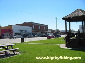
Map of Malta, MT 59538, USA
History
After James Hill and his partners built the St Paul, Minneapolis, and Manitoba railway (which in 1890 became the Great Northern Railway) across Montana's "High Line" in 1887, Malta evolved from rail siding number 54. What came to be Saco, Montana, to the east and Dodson, Montana, to the west grew from other nearby sidings. A post office was established in Malta in 1890. Its name is said to have been determined by a spin of the globe by a Great Northern official whose finger came to rest on the island of Malta in the Mediterranean Sea.
On July 3, 1901, Kid Curry (Harvey Logan), as part of Butch Cassidy's Wild Bunch, robbed a train just west of Malta, near Wagner, Montana, making off with about $40,000.
One of the best preserved dinosaurs ever discovered and one of only four that were mummified is a 77-million-year-old Brachylophosaurus nicknamed Leonardo, unearthed north of Malta in 2000. Leonardo, together with brachylophosaurs Elvis (1994), Roberta (2003) and Peanut (2002), is on display at The Great Plains Dinosaur Museum.
Two stops on The Montana Dinosaur Trail are located in Malta.
Geography
Malta is located at 48°21′20″N 107°52′17″W (48.355496, -107.871361).
Malta is on the High Plains of Montana. The Little Rocky Mountains are located south of the town. The city of Malta gets their water from wells. The well water is pumped to two water tanks located at the top of a residential area known as Hillcrest. The water is treated to meet safety standards, then it enters the city water distribution system.
According to the United States Census Bureau, the city has a total area of 1.06 square miles (2.75 km2), all of it land.
Malta experiences a semi-arid climate (Köppen BSk) with long, cold, dry winters and hot, wetter summers.
2010 census
As of the census of 2010, there were 1,997 people, 902 households, and 539 families residing in the city. The population density was 1,884.0 inhabitants per square mile (727.4/km2). There were 1,006 housing units at an average density of 949.1 per square mile (366.4/km2). The racial makeup of the city was 88.2% White, 0.1% African American, 5.5% Native American, 0.4% Asian, 0.3% from other races, and 5.7% from two or more races. Hispanic or Latino of any race were 2.0% of the population.
There were 902 households of which 26.6% had children under the age of 18 living with them, 46.8% were married couples living together, 10.0% had a female householder with no husband present, 3.0% had a male householder with no wife present, and 40.2% were non-families. 36.6% of all households were made up of individuals and 17.6% had someone living alone who was 65 years of age or older. The average household size was 2.16 and the average family size was 2.81.
The median age in the city was 46.8 years. 23.1% of residents were under the age of 18; 5.8% were between the ages of 18 and 24; 18.6% were from 25 to 44; 29.5% were from 45 to 64; and 23.2% were 65 years of age or older. The gender makeup of the city was 46.7% male and 53.3% female.
2000 census
As of the census of 2000, there were 2,120 people, 907 households, and 565 families residing in the city. The population density was 2,006.1 people per square mile (772.2/km2). There were 1,067 housing units at an average density of 1,009.7 per square mile (388.7/km2). The racial makeup of the city was 92.83% White, 0.05% African American, 4.67% Native American, 0.24% Asian, 0.05% Pacific Islander, 0.19% from other races, and 1.98% from two or more races. Hispanic or Latino of any race were 1.04% of the population.
There were 907 households out of which 28.3% had children under the age of 18 living with them, 49.9% were married couples living together, 9.7% had a female householder with no husband present, and 37.6% were non-families. 33.7% of all households were made up of individuals and 18.1% had someone living alone who was 65 years of age or older. The average household size was 2.27 and the average family size was 2.90.
In the city, the population was spread out with 24.7% under the age of 18, 5.8% from 18 to 24, 23.1% from 25 to 44, 24.3% from 45 to 64, and 22.1% who were 65 years of age or older. The median age was 43 years. For every 100 females there were 93.1 males. For every 100 females age 18 and over, there were 87.0 males.
The median income for a household in the city was $31,212, and the median income for a family was $41,422. Males had a median income of $30,117 versus $18,636 for females. The per capita income for the city was $16,405. About 8.8% of families and 13.1% of the population were below the poverty line, including 14.4% of those under age 18 and 8.8% of those age 65 or over.