
Population 4,413 (2011 census) Postcode(s) 5031 Founded 1860 | Established 1860 Area 181 ha Postal code 5031 | |
 | ||
Federal divisions Division of Adelaide, Division of Hindmarsh | ||
dashcam mawson lakes to mile end south australia
Mile End is an inner western suburb of Adelaide, located in the City of West Torrens, around 2 kilometres from the Adelaide city centre. It has a census area population of 4,413 people (2011). Much of the suburb is residential, but there are small commercial areas along Henley Beach Road and South Road.
Contents
- dashcam mawson lakes to mile end south australia
- Map of Mile End SA 5031 Australia
- History
- Housing
- Railway yards
- Heritage listings
- Demographics
- Federal
- State
- Transport
- Notable organisations
- Notable residents
- References
Map of Mile End SA 5031, Australia
History
Mile End was originally established in 1860 as The Town of Mile End by the South Australian Company. It was so named because the township was approximately one mile from the centre of Adelaide. It was also named after Mile End in east London, England, whose name has a similar meaning. It was part of the then largely rural District of West Torrens until 1883, when the residents of the more urban suburbs of Thebarton, Mile End and Torrensville successfully petitioned to become the Corporation of the Town of Thebarton. In 1997 the Town of Thebarton re-amalgamated with the City of West Torrens.
Mile End railway station, built in 1898, is also one mile from the Adelaide railway station.
Housing
At a time when much working-class housing was sub-standard, on his death in 1897 the wealthy philanthropist Thomas Elder left a bequest of £25,000 expressly to provide housing, 'libraries, schools, infant nurseries, laundries, baths and washhouses and for any other purpose tending in the opinion of the trustees to the health and moral welfare of working men and working women'. The bequest resulted in the formation of Adelaide Workmen's Homes Inc, and the trustees engaged the architects Edward Davies and Charles Walter Rutt to design a model estate of low-cost rental housing. in Rose Street, Mile End, which was built in 1901-2. This consisted of two rows of semi-detached cottages facing each other across the street, of red brick with dressed stone façades, and featuring crenellated parapets above the entrance porches. They are collectively listed among the 120 nationally significant 20th-century buildings in South Australia.
Railway yards
The Mile End Goods Yard and engine sheds opened in 1912, and the Gaol Loop was built to allow freight trains to access them, bypassing Adelaide railway station. This, along with the relocation of livestock markets and abattoirs to Pooraka (still countryside at the time), allowed the Adelaide station yards to concentrate on passenger and parcels traffic.
(See also Adelaide railway station#Early 20th century.)
The Mile End Goods Yard remained an important railway complex until the 1980s. Some original railway workers' cottages still exist in Mile End. However, during the 1980s, rail transport declined considerably in Australia and the importance of the Mile End Goods Yard declined with it. The Mile End Goods railway station, a station on the commuter line, was closed and demolished in 1994. Prior to its closure it serviced only a few trains in the morning and afternoon, at shift start and end time.
The Mile End Railway Museum was also located here until 1988, when the new Port Dock Railway Museum (National Railway Museum) opened in Port Adelaide as part of the bicentennial celebrations.
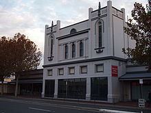
Heritage listings
Mile End contains a number of heritage-listed sites, including:
Demographics
According to the 2006 Census, the population of the Mile End census area was 3,918 people. Approximately 50.1% of the population were female, 62.5% were Australian born, 6.3% were born in Greece, over 81.3% of residents were Australian citizens and only 1.7% were native born indigenous people. Mile End has an educated population with over 40.8% of the population holding a degree, diploma or vocational qualification. This level of education attainment is reflected in the suburb's employment patterns: the most popular industries for employment were Health Care (11.9%), Retail Trades (11.6%) and Education (9.6%), while the unemployment rate was approx. 5.6%. The median weekly household income was A$918 or more per week, compared with $924 in Adelaide overall. 21.9% of the population identified themselves as Catholic, while a slightly higher 24.5% identified with no religion at all.
See also Greek Australians
Federal
Mile End is split between two federal electorates. To the east of South Road the suburb is a part of the division of Adelaide, and has been represented by Labor Shadow Minister for Education, Kate Ellis since 2004. As there are no polling booths in Mile End for the division of Adelaide, results here are taken from the city booths. Adelaide has a mix of working class and conservative voters, making the seat one of the most marginal in the country.
To the west of South Road the suburb is a part of the division of Hindmarsh, held by Liberal MP Matt Williams since 2013.
State
Mile End is also a part of the state electoral district of West Torrens, held by Labor MP Tom Koutsantonis since 2002.
Because West Torrens extends throughout the western suburbs of Adelaide, voters are mainly low to middle income earners of working-class backgrounds. Due to this the electorate is considered a safe Labor seat, held by a margin of 18.3% since the 2006 election.
Transport
Cars are the preferred mode of transport in the suburb. According to the Australian Bureau of Statistics 61.8% of residents are drivers or passengers of cars for their commute to work. Mile End is connected to the major Adelaide thoroughfares of South Road, Sir Donald Bradman Drive and Henley Beach Road. Adelaide's city centre can typically be reached by car in 5 minutes.
Because of the area's short distance from major business districts, a larger proportion (5.6%) walk to work, while a slightly smaller number (2.7%) use a bike. Good connections to Adelaide's public transport network mean that 13.5% take the bus to work, while a smaller 0.5% of people use the train. Bus routes connect Mile End to the Adelaide city centre as well as Adelaide Airport, Glenelg and various locations in the western suburbs. Mile End railway station is located on the Noarlunga, Tonsley and Belair commuter railway lines, however services outside of peak hour only run hourly and there are no weekend, public holiday or night services.
See also Transport in Adelaide
Notable organisations
Mile End is home to the national headquarters of the Australian Rail Track Corporation (ARTC).