
Postcode(s) 5095 State electorate(s) Port AdelaidePlayford Postal code 5095 | ||
 | ||
Location 12 km (7 mi) N of Adelaide city centre | ||
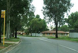
Pooraka (postcode: 5095) is a suburb in Adelaide, South Australia. It is around 11-12 km north of the central business district.
Contents
Map of Pooraka SA 5095, Australia
Pooraka East Post Office opened on 1 December 1965 and closed in 1986.
History
The origin of the name Pooraka is obscure. Originally known as "Dry Creek" after the name of the local post office, in 1916, the District Council of Yatala renamed the suburb Pooraka, which they believed to be an Indigenous Kaurna word meaning "dry creek," however, the name bears no resemblance to the Kaurna words for 'dry' or 'creek'. Pooraka, with the same spelling, has been identified as an Indigenous New South Wales name for the 'turpentine tree' which is not found in South Australia.
References
Pooraka, South Australia Wikipedia(Text) CC BY-SA