
Population Uninhabited | Area 184 km² | |
 | ||
Michipicoten island
Michipicoten Island is an island in Ontario, Canada, in the northeastern part of Lake Superior, about 175 kilometres (109 mi) northwest of Sault Ste. Marie and 65 kilometres (40 mi) southwest of Wawa, Ontario. It falls within the boundaries of Thunder Bay District.
Contents
- Michipicoten island
- Map of Michipicoten Island Unorganized Thunder Bay District ON Canada
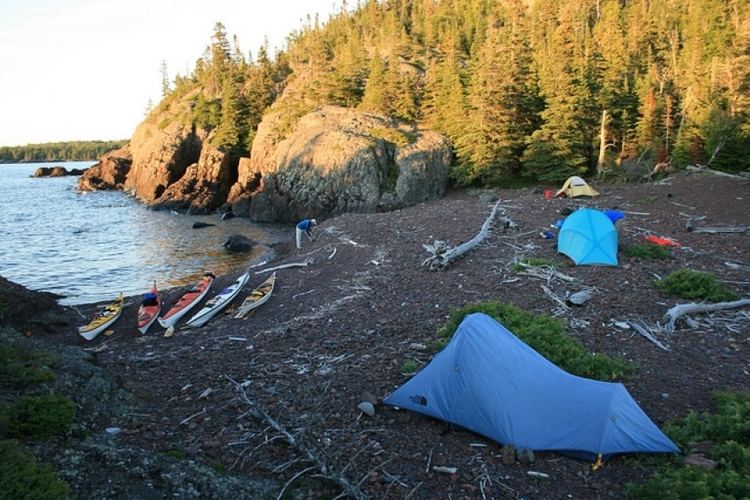
- Michipicoten island july 2015
- References
Map of Michipicoten Island, Unorganized Thunder Bay District, ON, Canada
The third largest island in Lake Superior, Michipicoten Island is 27 kilometres (17 mi) long and 10 kilometres (6.2 mi) wide at its widest point. Uninhabited by humans and with plentiful wildlife (notably beaver, woodland caribou, and birds), it has become a destination for some adventurous kayakers. At its closest point to mainland Ontario, the island is located about 16 kilometres (9.9 mi) from land.
The entire island is administered by Ontario Parks as Michipicoten Island Provincial Park. The island is made up of ancient lava bedrock related to volcanism of the Midcontinent Rift System and is heavily forested, with several inland lakes.
A lighthouse was established in 1912 on the eastern end of the island. It was staffed until 1988.
On some old maps, Michipicoten Island is shown as Isle Maurepas, after the French minister of Marine Jean-Frédéric Phélypeaux, Count of Maurepas. The word Michipicoten is an Anglicization of the original Ojibwe word Mishipikwadina, meaning "big bluffs" in Ojibwe, and is a reference to the geography of the nearby Michipicoten River.