
Country Mexico Time zone PST (UTC−8) Area 13,700 km² | Municipality established December 29, 1953 INEGI code 002 Population 936,826 (2010) Largest city Mexicali | |
 | ||
Clubs and Teams Águilas de Mexicali, Soles de Mexicali Points of interest Sierra de San Pedro Mártir Nat, Museo Sol del Niño, Centenario Park, Cañón De Guadalupe, Cathedral of Our Lady of Guadal Colleges and Universities Autonomous University of Baja C, Centro de Enseñanza Técnica y, Mexicali Institute of Technology, Xochicalco University, Universidad de la Veracruz | ||
Mexicali Municipality is a municipality (Spanish: municipio) in the Mexican state of Baja California. Its municipal seat (Spanish: cabecera municipal) is located in the city of Mexicali. As of 2010, the municipality had a total population of 936,826, and according to the 2000 census, it had 764,602 inhabitants. The municipality has an area of 13,700 km² (5,300 sq mi.) This includes many smaller outlying communities as well as the city of Mexicali. Also, the islands of Baja California located in the Gulf of California are part of the municipality, among them the mudflat islands at the mouth of the Colorado River (the largest one being Montague Island), Isla Ángel de la Guarda and the islands of the San Lorenzo Marine Archipelago National Park. Mexicali is the northernmost municipality of Latin America.
Contents
- Map of Mexicali Baja California Mexico
- Boroughs
- Cities and towns
- Adjacent municipalities and counties
- References
Map of Mexicali, Baja California, Mexico
The city of Mexicali was founded in 1903, and its name is a portmanteau of Mexico and California, as is the name of Calexico, California across the border.
Boroughs
The municipality of Mexicali, is divided into 14 administrative boroughs (Spanish: delegaciones) of which the city of Mexicali occupies 3 beside the city proper area; all boroughs are in turn divided into colonias or ejidos. These boroughs offer administrative services such as urban planning, civil registry, inspection, verification, public works and community development and are served by a delegado.
The boroughs of Mexicali Municipality city are:
- Los Algodones, located in the Valley Zone.
- Batáquez, located in the Valley Zone.
- Cerro Prieto, located in the Urban Zone, is part of the Mexicali metropolitan area.
- Venustiano Carranza, located in the Valley Zone.
- Ciudad Morelos, informally known as Cuervos, located in the Valley Zone.
- Colonias Nuevas, informally known as Km 57, located in the Valley Zone.
- Progreso, located in the Urban Zone, is part of the Mexicali metropolitan area.
- Ejido Hermosillo, located in the Valley Zone.
- Estación Delta, located in the Valley Zone.
- Guadalupe Victoria, informally known as Km 43, located in the Valley Zone.
- González Ortega, informally known as Palaco, located in the Urban Zone, is part of the Mexicali metropolitan area.
- Hechicera, located in the Valley Zone.
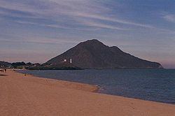
- San Felipe, located in the Coastal Zone, to the south on the Gulf of California.
- Benito Juárez, informally known as Tecolotes, located in the Valley Zone.
The former borough (delegación) of Compuertas is located in the eastern part of the city of Mexicali.
Cities and towns
As of 2010, the city of Mexicali had a population of 936,826. Other than the city of Mexicali, the municipality had 2,553 localities, the largest of which (with 2010 populations in parentheses) were: Santa Isabel (29,311), Ciudad Guadalupe Victoria (Kilómetro Cuarenta y Tres) (17,119), San Felipe (16,702), Puebla (15,168), Progreso (12,557), Ciudad Morelos (Cuervos) (8,243), Colonia Venustiano Carranza (La Carranza) (6,098), Ciudad Coahuila (Kilómetro Cincuenta y Siete) (5,617), Vicente Guerrero (Algodones) (5,474), Delta (Estación Delta) (5,180), EJido Hermosillo (5,101), Benito Juárez (Ejido Tecolotes) (4,167), Nuevo León (3,655), Poblado Paredones (3,332), Michoacán de Ocampo (3,086), Ejido Hechicera (2,517), Viñas del Sol (2,509), Ejido Sinaloa (Estación Kasey) (2,505), classified as urban, and Ejido Lázaro Cárdenas (La Mosca) (2,463), Poblado Lázaro Cárdenas (La Veintiocho) (2,388), Ejido Quintana Roo (2,311), Islas Agrarias Grupo A (1,979), Ejido Jiquilpan (1,681), Ejido Plan de Ayala (1,654), Ejido Yucatán (1,628), Ejido Durango (1,593), Ejido Saltillo (1,560), Ejido Pátzcuaro (1,513), Ejido Sonora (1,507), Nayarit Llamada (1,486), Ejido Vicente Guerrero (1,463), Ejido Veracruz Dos (1,446), Ejido Colima 1 (1,379), Colonia José María Rodríguez Mérida (La Panga) (1,275), Rincones del Puebla (1,175), Ejido Monterrey (Colonia Batáquez) (1,121), Ejido Netzahualcóyotl (1,064), Ejido Toluca (1,060), Islas Agrarias Grupo B (1,054), Estación Pescaderos (Kilómetro Treinta y Nueve) (1,051), Ejido Tabasco (1,029), Veracruz Uno (1,023), and Ejido Doctor Alberto Oviedo Mota (El Indiviso) (1,009), classified as rural.