
Population 3,718 (2011 census) Unitary authority Sovereign state United Kingdom | OS grid reference SE893042 Dialling code 01724 | |
 | ||
Region | ||
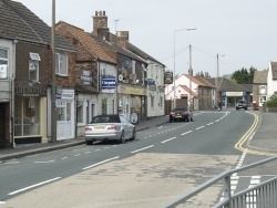
Messingham is a village and civil parish in North Lincolnshire, England.
Contents
Map of Messingham, UK
The village is situated on the A159, 4 miles (6 km) south from the centre of Scunthorpe and 1 mile (1.6 km) south from the M180. West Lindsey is 1 mile to the south, as is Scotter.
Messingham has a population of over 4,000 people, falling to 3,718 at the 2011 census.
Messingham members match
Community
The village has a history of sheep farming.
Schools serving the village are Messingham Primary School, Frederick Gough School, Queen Elizabeth High School and Huntcliff. The parish church is dedicated to the Holy Trinity. There is also a Methodist church, on 24 July 1772. John Wesley was known to preach in Messingham, possibly at the site of the Green Tree public house. Village public houses are the Horn Inn, Green Tree Inn and Crown Inn on High Street, and the Bird in the Barley on Northfield Road (A159).
Scunthorpe's 'British Steel' steel works is a major employer of local people.
On the outskirts of Messingham is Grange Park Golf Club, and nearby on the B1400 road, a nature reserve. The Sand Quarry is a Site of Special Scientific Interest.
Sport
Messingham has various sports clubs. Football, Cricket and Bowls clubs are based at the Northfield Road site.