
Airport type Public 1/19 5,121 Code MFH | Elevation AMSL 1,978 ft / 603 m 5,121 1,561 Elevation 602 m | |
 | ||
Landing at mesquite airport
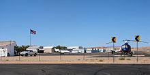
Mesquite Airport (IATA: MFH, FAA LID: 67L) is a public use airport located two nautical miles (4 km) north of the central business district of Mesquite, in Clark County, Nevada, United States. It is owned by the City of Mesquite.
Contents
- Landing at mesquite airport
- My first solo flight in cessna 172r at mesquite airport khqz
- Facilities and aircraft
- References
The National Plan of Integrated Airport Systems for 2011–2015 categorized it as a general aviation facility.
My first solo flight in cessna 172r at mesquite airport khqz
Facilities and aircraft
Mesquite Airport covers an area of 155 acres (63 ha) at an elevation of 1,978 feet (603 m) above mean sea level. It has one runway designated 1/19 with an asphalt surface measuring 5,121 by 75 feet (1,561 x 23 m). It also has one helipad designated H1 with a concrete surface measuring 20 by 20 feet (6 x 6 m).
For the 12-month period ending January 31, 2011, the airport had 15,050 aircraft operations, an average of 41 per day: 99.7% general aviation and 0.3% military. At that time there were 22 aircraft based at this airport: 86% single-engine, 9% ultralight, and 5% jet.