
Airport type Public 11/29 4,479 Elevation 113 m Phone +1 831-385-3281 | Owner City of King City Elevation AMSL 374 ft / 114 m 4,479 1,365 Code KIC | |
 | ||
Address Metz-King City Rd, King City, CA 93930, USA Similar Motel 6, Mee Memorial Hospital, San Lorenzo Park, Metz, Monterey County Agricultur | ||
Landing at king city ca in hd mesa del rey airport kkic
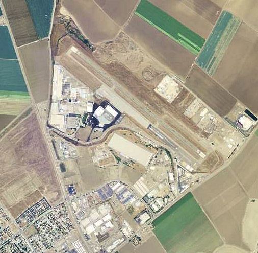
Mesa Del Rey Airport (IATA: KIC, ICAO: KKIC, FAA LID: KIC) is a city owned, public use airport located one nautical mile (2 km) northeast of the central business district of King City, in Monterey County, California, United States. It is included in the National Plan of Integrated Airport Systems for 2011–2015, which categorized it as a general aviation facility.
Contents
History
Opened in April 1940 as Palo Alto Airport or King City Airport. Originally had 4,570' NW/SE hard surfaced runway. It was used for most of World War II by the United States Army Air Forces as a primary (level 1) contract pilot training airfield. It also had four local auxiliary airfields for emergency and overflow landings. Pilot training contractor was Palo Alto Airport, Inc. Flying training was performed with Fairchild PT-19s as the primary trainer. It also had several PT-17 Stearmans as well. Known sub-bases and auxiliaries were:
Military control of the airport was transferred to the United States Navy in April 1945. It was known as King City Naval Auxiliary Air Station (NAAS). The Navy declared airport surplus on 30 September 1945. Eventually it was discharged to the War Assets Administration (WAA) and became a civil airport.
Facilities and aircraft
Mesa Del Rey Airport covers an area of 149 acres (60 ha) at an elevation of 374 feet (114 m) above mean sea level. It has one runway designated 11/29 with an asphalt surface measuring 4,479 by 100 feet (1,365 x 30 m).
For the 12-month period ending February 25, 2009, the airport had 7,862 general aviation aircraft operations, an average of 21 per day. At that time there were 19 aircraft based at this airport: 90% single-engine, 5% multi-engine, and 5% helicopter.