
Country United States County San Mateo Elevation 72 ft (22 m) Local time Saturday 6:19 PM | Incorporated November 23, 1927 Area code 650 | |
 | ||
Weather 19°C, Wind N at 10 km/h, 50% Humidity | ||
Menlo Park is a city at the eastern edge of San Mateo County, in the San Francisco Bay Area of California, in the United States. It is bordered by San Francisco Bay on the north and east; East Palo Alto, Palo Alto, and Stanford to the south; Atherton, North Fair Oaks, and Redwood City to the west. Menlo Park is one of the most educated cities in the state of California and the United States, with nearly 70% of its residents having earned a degree. Menlo Park had 32,026 inhabitants according to the 2010 United States Census.
Contents
- Map of Menlo Park CA USA
- Geography
- History
- 2010
- 2000
- Government and politics
- County state and federal representation
- Education
- Economy
- Top employers
- References
Map of Menlo Park, CA, USA
Geography
According to the United States Census Bureau, the city has a total area of 17.4 square miles (45 km2), of which 9.8 square miles (25 km2) is land and 7.6 square miles (20 km2) is water. The total area is 43.79% water. Menlo Park is long and narrow on a northeast to southwest axis. The northeast portion borders the San Francisco Bay and includes the Dumbarton Bridge that connects Menlo Park to Fremont on the east side of the bay. The city shoreline includes the city's largest park, Bedwell Bayfront Park 160 acres (65 ha) and the Don Edwards San Francisco Bay National Wildlife Refuge. San Francisquito Creek marks much of the southeast border of the city. West Menlo Park (not part of the city despite its name) along Alameda de las Pulgas nearly separates the southwestern part of the city (known as Sharon Heights) from the rest. The extreme southwest is clipped by Interstate 280.
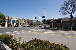
The Bayshore Freeway (part of U.S. Route 101) traverses Menlo Park northwest to southeast near the shoreline and somewhat parallel to it to the southwest is El Camino Real. The intersection of El Camino Real and Santa Cruz Avenue is considered the heart of the city. Nearby, the Menlo Park Civic center is bounded by Ravenswood Avenue, Alma Street, Laurel Street and Burgess Drive. It contains the council offices, library, police station and Burgess Park which has various recreational facilities. Other major roads include Sand Hill Road in the Sharon Heights area.
The residential areas of Menlo Park are unofficially divided into several neighborhoods. Belle Haven is the only neighborhood east of the Bayshore Freeway; much of the rest of that area is business or protected land. Between Middlefield road (a road almost parallel to Bayshore) and Bayshore are the neighborhoods of the Willows, Suburban Park, Lorelei Manor, Flood Triangle, Vintage Oaks, and South of Seminary (the seminary being Saint Patrick's Seminary). Between Middlefield and El Camino Real are Felton Gables, Linfield Oaks, and Park Forest. West of El Camino Real until the hills are the neighborhoods of Downtown Menlo Park, Central Menlo Park, and Allied Arts (sometimes also known as Stanford Park, it is named for the Allied Arts Guild in it). In the hills are Sharon Heights and Stanford Hills. Several other neighborhoods are closely associated with Menlo Park but are actually in unincorporated San Mateo county; these include Menlo Oaks and Fair Oaks (latter part of the North Fair Oaks census area) between Bayshore and Middlefield, University Heights (also known as West Menlo Park) between Sharon Heights and most of the rest of the city, and Stanford Weekend Acres which is somewhat near Stanford Hills.
History
The area of Menlo Park was inhabited by the Ohlone people. In 1795 the Rancho de las Pulgas land grant was made that include the area of the current city.
In 1851 two Irish immigrants, Dennis J. Oliver and his brother-in-law D. C. McGlynn, purchased a 1,700-acre (690 ha) tract of land on the former Rancho de las Pulgas. In the 1854 they erected a gate with a wooden arch bearing the inscription "Menlo Park" and the date "August 1854" at the entrance to their property (now the intersection of Middle Ave and El Camino Real). The word "Menlo" derived from the owners' former home of Menlo in County Galway, Ireland, and is an Anglicized version of the original Irish name of the place, Mionloch, meaning "middle lake".
In 1863, the San Francisco and San Jose Rail Road had built the railroad from San Francisco to as far as Mayfield (now California Avenue station in Palo Alto) and started running trains to the area. They named a nearby station "Menlo Park" after the sign. The 1867 station building still stands on the platform of the current Caltrain station, used by the local Chamber of Commerce. The town of Menlo Park grew up around this station, becoming a popular home for San Francisco businessmen. A post office arrived in 1870, and the city was incorporated in 1874. The original arch which gave its name to the stations and ultimately the city survived until 1922, when it was destroyed in an automobile accident. The origin of the name of Menlo Park, California (ca 1850) pre-dates any work done by Thomas Edison (ca 1876) in Menlo Park, New Jersey.
In 1917/1918 a large portion of Menlo Park was the site of Camp Fremont, a training camp for, at its height, 27,000 men being sent to fight in World War 1. It didn't last long, the camp was dismantled after the war, but army engineers paved the first streets in Menlo Park and laid the first water and gas lines. The army did retain the camp hospital and that is now the site of a Veterans Administration hospital off of Willow road in Menlo Park. In the autumn of 1918 the 1918 flu pandemic hit Camp Fremont and killed 147.
The city originally incorporated in 1874 but dissolved after two years; it was permanently incorporated in 1927.
At the start of World War 2 the US government bought the 260-acre (110 ha) estate of Timothy Hopkins from his widow and created the Palo Alto General Hospital later renamed the Dibble General Hospital (after Colonel John Dibble who was killed in 1943). After the war ended some of the land was sold to the city and is where the main library and city hall exist. More of the land was bought by Stanford University to house the increase in students due to the G.I. bill; the area was known as the "Stanford Village" which existed as student housing until the mid-1960s. This land also was the site of the Stanford Research Institute (now SRI International) starting in 1947; between 1955 and 1968 SRI bought the rest of the Stanford Village.
In the 1960s the former 600 acres (240 ha) estate of Frederick W. Sharon (1859–1914) (son of Senator William Sharon) and his wife, Louise Tevis Breckinridge Sharon (1858–1938) (daughter of Lloyd Tevis and divorced wife of John Witherspoon Breckinridge), in the hills of south west Menlo Park was developed and called "Sharon Heights".
2010
The 2010 United States Census reported that Menlo Park had a population of 32,026. The population density was 3,271.3 people per square mile (1,263.1/km²). The racial makeup of Menlo Park was 22,494 (70.2%) White, 1,551 (4.8%) African American, 156 (0.5%) Native American, 3,157 (9.9%) Asian, 454 (1.4%) Pacific Islander, 2,776 (8.7%) from other races, and 1,438 (4.5%) from two or more races. There were 5,902 people (18.4%) of Hispanic or Latino background, of any race. Among the Hispanic population, 4,303 were of Mexican ancestry.
The Census reported that 31,181 people (97.4% of the population) lived in households, 599 (1.9%) lived in non-institutionalized group quarters, and 246 (0.8%) were institutionalized.
There were 12,347 households, out of which 4,112 (33.3%) had children under the age of 18 living in them, 6,163 (49.9%) were opposite-sex married couples living together, 1,039 (8.4%) had a female householder with no husband present, 371 (3.0%) had a male householder with no wife present. There were 642 (5.2%) unmarried opposite-sex partnerships, and 102 (0.8%) same-sex married couples or partnerships. 3,672 households (29.7%) were made up of individuals and 1,371 (11.1%) had someone living alone who was 65 years of age or older. The average household size was 2.53. There were 7,573 families (61.3% of all households); the average family size was 3.20.
In terms of age 7,805 residents (24.4%) were under the age of 18, 1,817 people (5.7%) aged 18 to 24, 9,563 people (29.9%) aged 25 to 44, 8,263 people (25.8%) aged 45 to 64, and 4,578 people (14.3%) who were 65 years of age or older. The median age was 38.7 years. For every 100 females there were 93.7 males. For every 100 females age 18 and over, there were 91.5 males.
There were 13,085 housing units at an average density of 1,336.6 per square mile (516.1/km²), of which 6,927 (56.1%) were owner-occupied, and 5,420 (43.9%) were occupied by renters. The homeowner vacancy rate was 1.1%; the rental vacancy rate was 5.2%. 18,972 people (59.2% of the population) lived in owner-occupied housing units and 12,209 people (38.1%) lived in rental housing units.
2000
As of the census of 2009, there were 33,690 people, 12,543 households, and 7,248 families residing in the city. The population density was 3,441.3 inhabitants per square mile (1,328.7/km2). There were 14,026 housing units at an average density of 1,432.7 per square mile (553.2/km²). 64.2% spoke English, 19.5% Spanish, other Indo-European 4.2%, 4.6% Chinese or Mandarin, and other language 0.7%, as their first language from estimate census 2009.
There were 12,543 households out of which 25.8% had children under the age of 18 living with them, 41.5% were married couples living together, 10.8% had a female householder with no husband present, and 45.67% were non-families. 35.1% of all households were made up of individuals and 11.1% had someone living alone who was 65 years of age or older. The average household size was 2.46 and the average family size was 3.15.
In the city, the population was spread out with 25.8% under the age of 18, 9.1% from 18 to 24, 31.5% from 25 to 44, 20.4% from 45 to 64, and 14.2% who were 65 years of age or older. The median age was 32 years. For every 100 females there were 94.0 males. For every 100 females age 18 and over, there were 90.6 males.
As of the 2000 estimate census, the median income for a household in the city was $82,609. Males had a median income of $77,766 versus $59,101 for females. The per capita income for the city was $51,341. About 5.9% of families and 7.3% of the population were below the poverty line, including 9.8% of those under age 18 and 8.7% of those over age 64. As of 2009 the median income for a family was $123,251.
Government and politics
City Council members are elected at-large to staggered, 4-year terms, in non-partisan municipal elections held every two years.
County, state, and federal representation
On the San Mateo County Board of Supervisors, Menlo Park is split between Supervisorial District 3 (west of El Camino Real) and Supervisorial District 4 (east of El Camino Real). represented by Don Horsley and Warren Slocum, respectively.
In the California State Legislature, Menlo Park is in the 13th Senate District, represented by Democrat Jerry Hill, and in the 24th Assembly District, represented by Democrat Marc Berman.
In the United States House of Representatives, Menlo Park is split between California's 14th (east of Bayshore) and 18th (west of Bayshore) congressional districts, represented by Jackie Speier (D–Hillsborough) and Anna Eshoo (D–Atherton), respectively.
Education
For primary schools, the central portions of Menlo Park are served by the Menlo Park City School District, while the Belle Haven neighborhood and VA hospital are served by the Ravenswood City School District, and the Sharon Heights and Stanford Hills neighborhoods served by the Las Lomitas Elementary School District. For high school, Menlo Park is part of the Sequoia Union High School District, with all of Menlo Park falling into the boundaries of Menlo-Atherton High School.
Catholic parochial schools are St. Raymond Catholic Elementary School and Nativity Elementary School. Peninsula School is a private progressive primary school. Trinity School is an Episcopalian elementary school. Alto International School, formerly known as German-American International School, with about 315 students, K-12, is also in the city.
For higher education, Saint Patrick's Seminary and University is a Catholic seminary in Menlo Park. Fuller Theological Seminary, an evangelical Christian school, has a branch campus in Menlo Park. Menlo College and Menlo School, which is a prep school, despite their names are in neighboring Atherton.
There are two libraries within the city, the Main branch and the Belle Haven branch. These libraries are part of the Peninsula Library System and share many resources with other nearby libraries.
Economy
Much of Menlo Park's economy revolves around the companies on Sand Hill Road, consisting of venture capital, private equity, financial services, law firms, and other professional service companies and investment vehicles focusing on technology. Geron, Robert Half International, Exponent, Sunset and SRI International are among the companies based in Menlo Park. Facebook moved its headquarters to the former campus of Sun Microsystems in Menlo Park in December 2011.
Top employers
As of 2012, Facebook announced it would be the biggest employer in Menlo Park at 6,600 employees. According to the city's 2015 Comprehensive Annual Financial Report, the top employers in the city were: